|
We continued on up Highway 4 past the downhill area and past the gate that would normally be
closed at this time of year. After a couple more miles, after we passed Alpine Lake on the right,
we turned right and then right again past the Pine Martens campground. The hiking book I had
said to drive past the campground and park in the lot by the trailhead. Unfortunately the lot
was closed, so we backed up and parked at the the campground entrance. The campground was
obviously closed, and we were the only car in the area. Most everyone else avoided the icy/snowy
road by parking closer to the lake, right next to Highway 4.
It was a bright sunny day, perhaps in the high 40's as we prepared to hike around the lake.
I didn't think there'd be enough snow for snowshoes, but there was still enough that we put on
our winter boots. We hiked along the road past the closed gate. Soon we saw a sign pointing
us to the right, to the Lakeshore Trail and Inspiration Point. Inspiration Point leads to
a vista up above to the left. We'd be sticking to the lake on this trip, though.
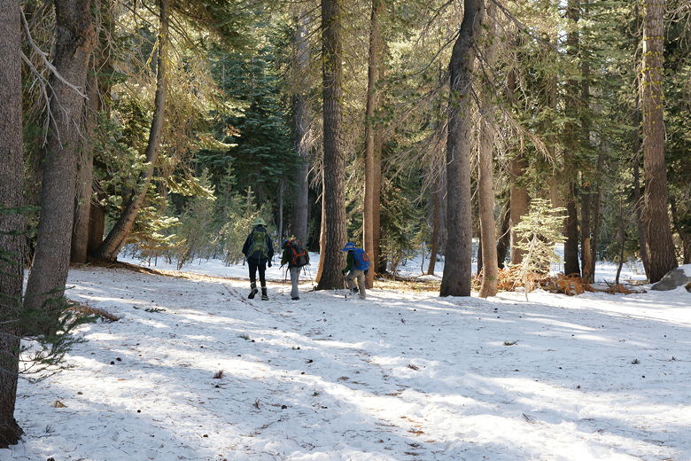
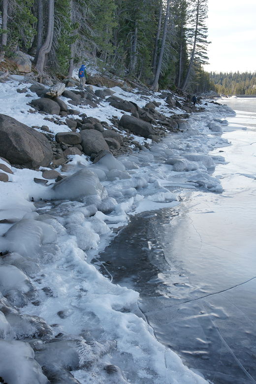
Hiking through the forest to the lake
We walked across the snow (about 2-3 inches deep in most places), in the forest toward tha lake.
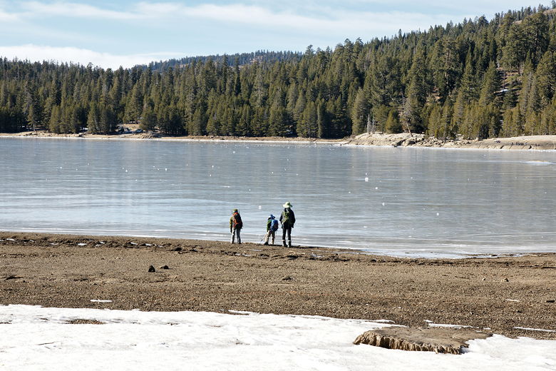
Soon we saw the lake and veered right out of the trees and to the shore. A buoy lay on the
bare ground to our right; clearly the water levels were much less than they would be during
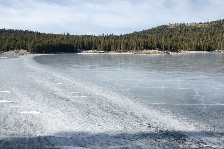
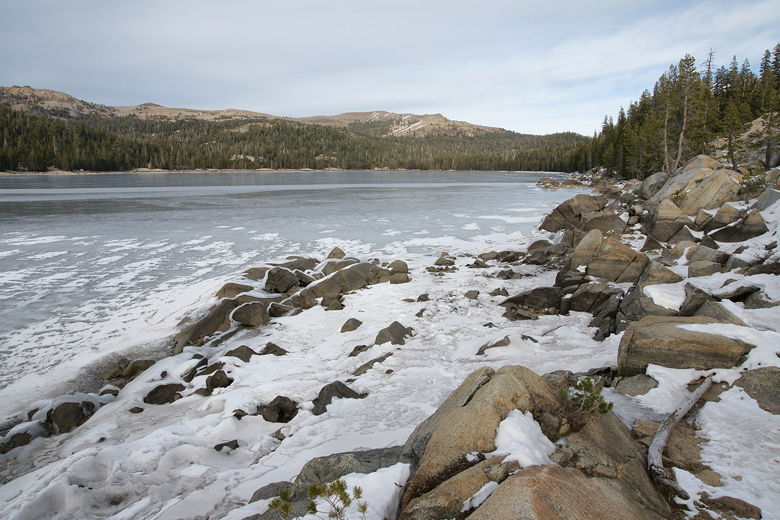
the spring after everything had thawed. The lake itself was frozen all the way across.
This is probably the largest lake I've ever seen which was frozen with no snow on top of it.
(Lake Tahoe never freezes, and Echo Lake was covered with snow when we crossed it).
Looking out across frozen Lake Alpine
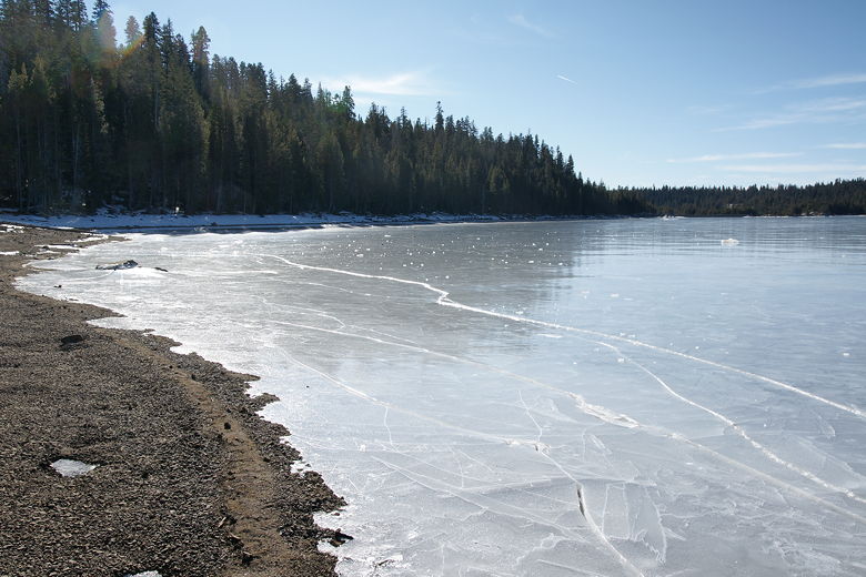
Frozen Lake Alpine
Cracks were visible close to the shore, but it looked mostly solid beyond that. People were
visible on the northwestern shore, walking or skating across the frozen surface. We took advantage
of this rare opportunity to throw chunks of ice or snow across the lake. Think curling
(which I've never tried).
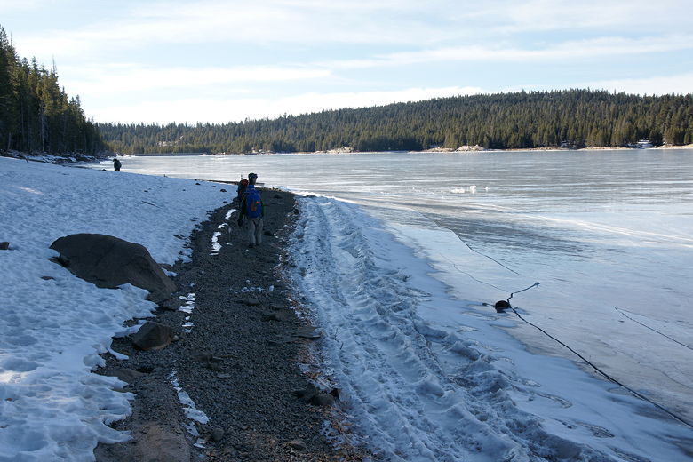
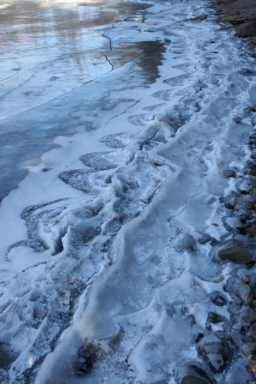
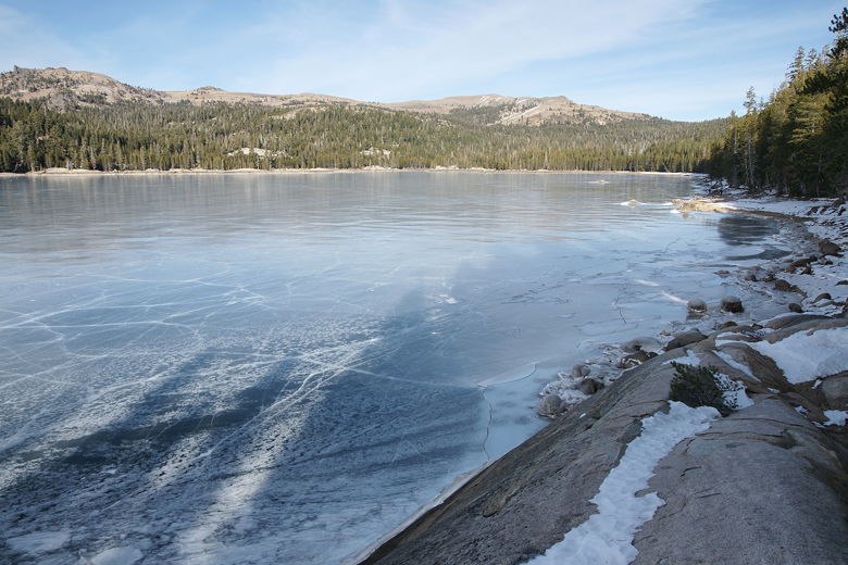
Hiking up the shore of the lake, snow on the left, ice on the right
Eventually we made our way southwest along the southeastern shore of the lake. As we did so, we saw
interesting formations in the ice. One place looked like a wave had been frozen in place.
In another place, interesting ice patterns formed around rocks. As we walked, we thought that
the sounds we heard were caused by the many people on the northwestern shore of the lake. It wasn't
until we stopped for lunch that we figured out that the sounds we were hearing were the sounds
of the ice shifting. Somes it sounded like distant drumming. While we ate lunch by the shore,
we started to hear a massive section of ice start to crack -- it sounded quite scary, even though
we were standing on solid ground.
Ice formations along the shore
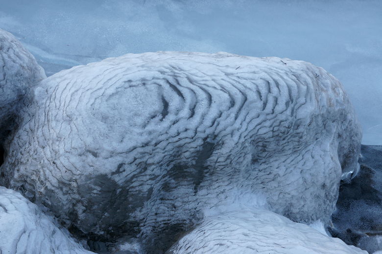
Ice formations on rock
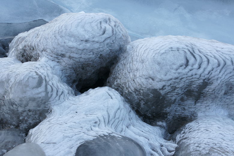
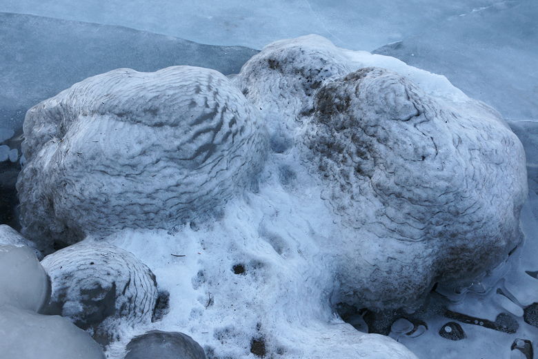
Ice-covered rocks along the shore
After lunch, we continued along the shore. Soon we came to a point where we couldn't stay
on the shore, so we headed inland and eventually joined what was apparently the main trail.
We figured it would meet up with the dam on the southwestern shore, and then we'd cross the dam and
continue around the lake on the other side. We were wrong. The trail eventually crossed the
creek, but I knew we'd gone past the dam by this point. So I figured we should head east.
We did so, but came to another bridge crossing back to the side of the creek we'd just been
on. Any thoughts of continuing to head east on the side we were on were dashed when we
saw private property signs. So we resigned ourselves to crossing the bridge and heading east
on that side. It eventually reached the area just below the dam.
Near the southwestern end of Lake Alpine
Lake Alpine
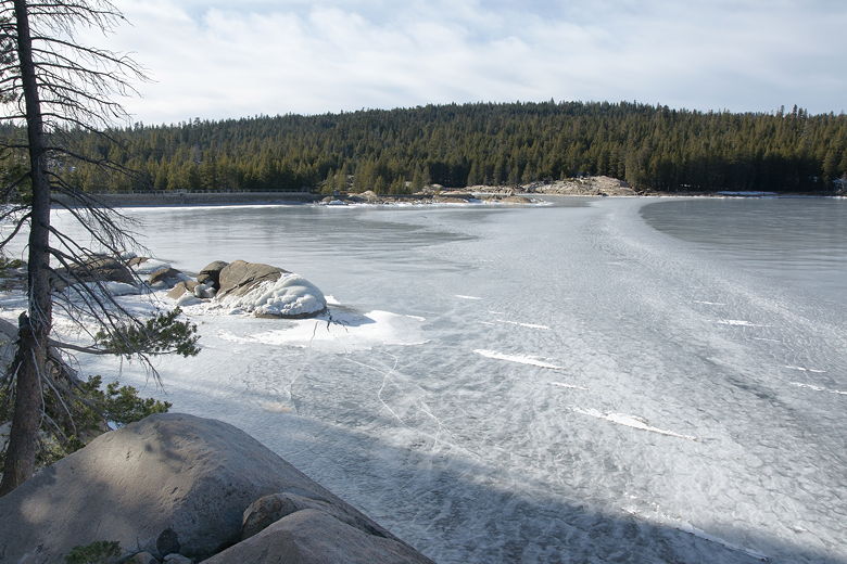
Lake Alpine dam (far left)
We clambored up to the southeastern edge of the dam, but a closed gate prevented us from actually
crossing the dam. A pair of hikers behind us were in a similar predicament, as they had also
planned to
circle the lake, but also reached the dam and turned around.
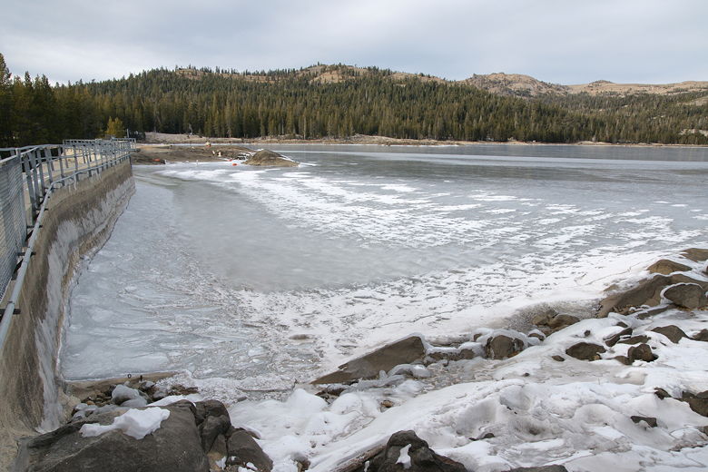
Closer look at the dam
View from the end of the dam
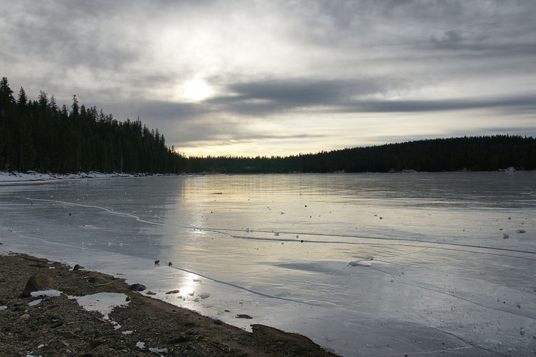
As it was starting to get late in the afternoon, and the skies were completely overcast now, we
decided not to fight it and just head back to our car. We continued east and eventually rejoined
the trail we'd been on before, now in the opposite direction. If you want to do a loop around the
lake, I think you have to travel further downstream from the dam before you get to the other side.
It would probably be easier to follow in the summer.
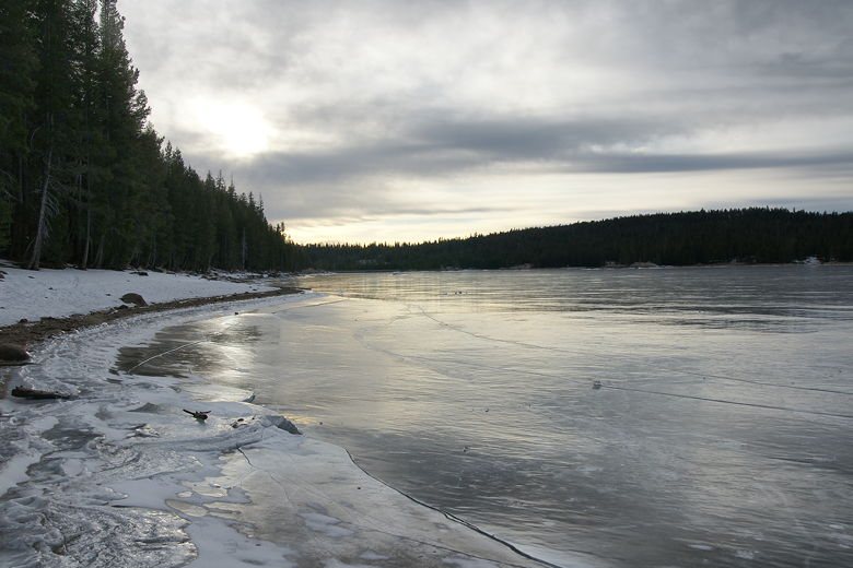
Late afternoon sun over Lake Alpine
We reached the buoy again, re-entered the forest, and soon reached our car.
| 

