|
We stopped in front of the visitor's center just before starting our hike. As we waited
to talk to the ranger in front of the map there, a couple sprayed sunscreen on. Unfortunately
it was a windy day and it blew right into my eyes, stinging me. I cried out as if someone
had maced me, wondering what was going on. It took me a few seconds to realize what had
happened. The couple was oblivious,
but I didn't say anything since it was obviously an accident. The ranger saw all this,
though, and joked that now we didn't need to put on sunscreen.
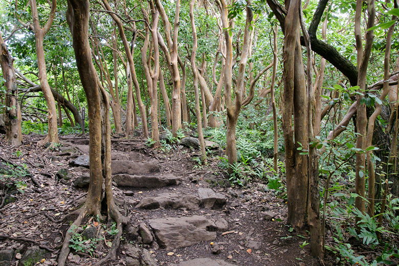
We started off to the right, starting the short half-mile loop that would take us by the pools with views of a couple waterfalls. We passed hala trees, which have fruit that looks like pineapple. The trail heads toward the coast and then passes by a small archealogical site. Then it veers left and passes a staircase leading down toward the pools. There's a gate here that looks like it sometimes is closed during flash floods. Now, however, it was open, and we were able to walk down and view the pools and falls along with lots of other visitors.
Banyan tree
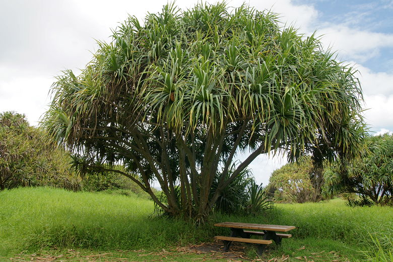
Hala tree
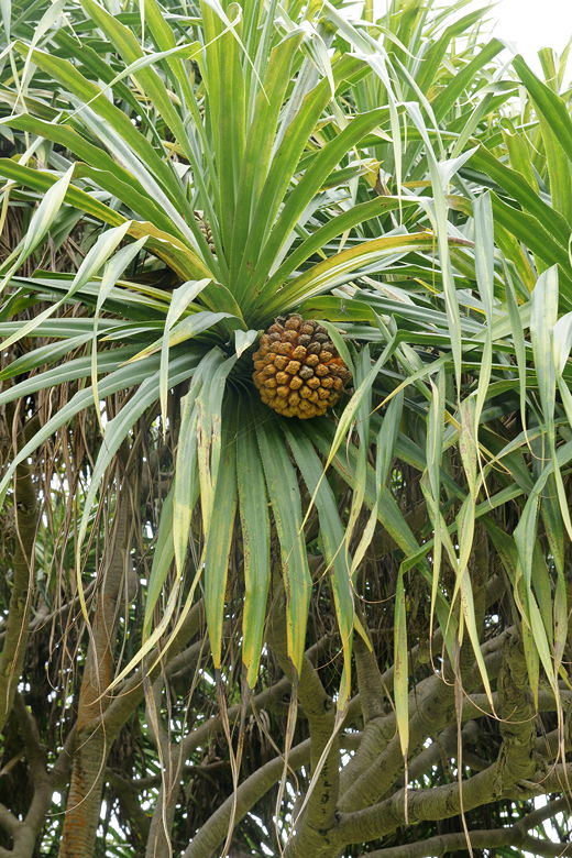
Hala fruit (aka "fake pineapple")
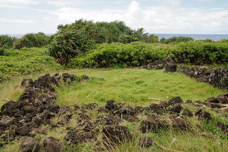
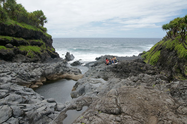
Ruins near Kuloa Point
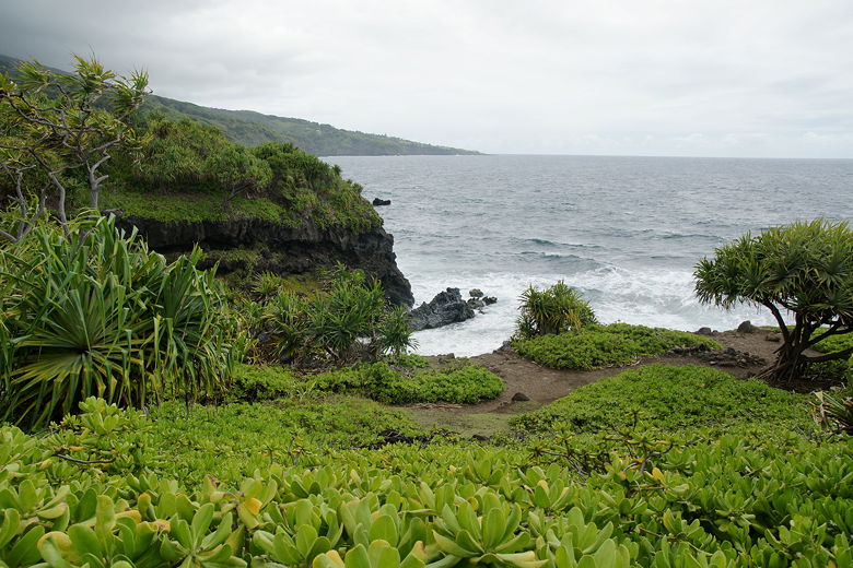
Coast near Kuloa Point
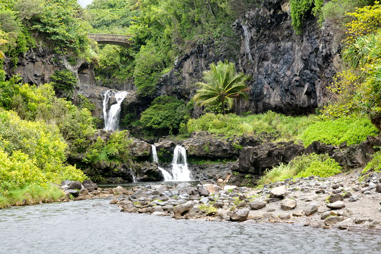
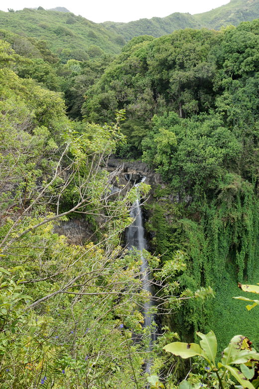
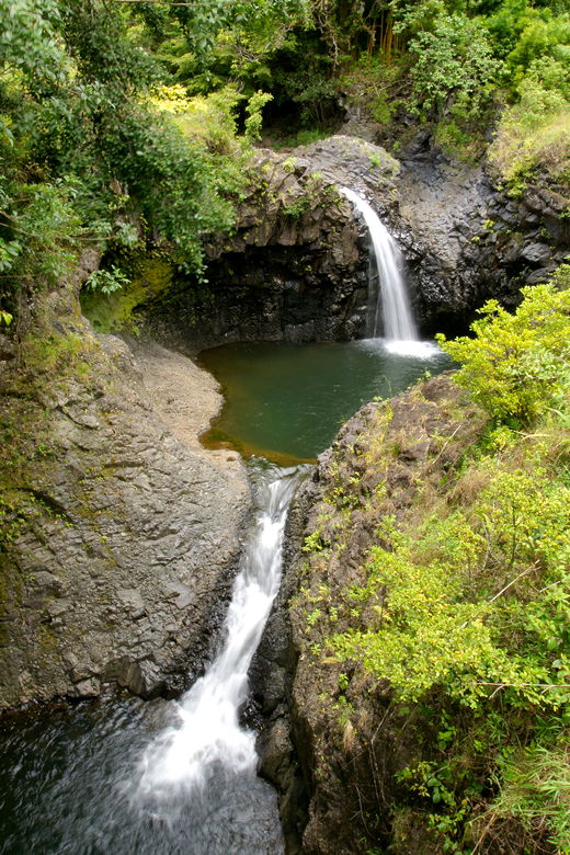
Two waterfalls were clearly visible, leading down into the pools in front of us. It was quite windy, making it hard to take pictures, but I tried anyway.
Falls in Oheo Gulch
Pools at the mouth of Oheo Gulch
After a few minutes of taking pictures, we went back up the stairs and continued the loop trail. Soon
enough we were done with the loop part and headed right up the trail toward the falls. Almost
immediately we passed an old native Hawaiian storage building, called a Hale Ku'ai. An interpretive
sign explains how the house is built and the different types of Hawaiian houses.
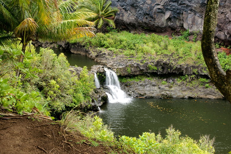
Falls and pool in Oheo Gulch
Paved section of trail
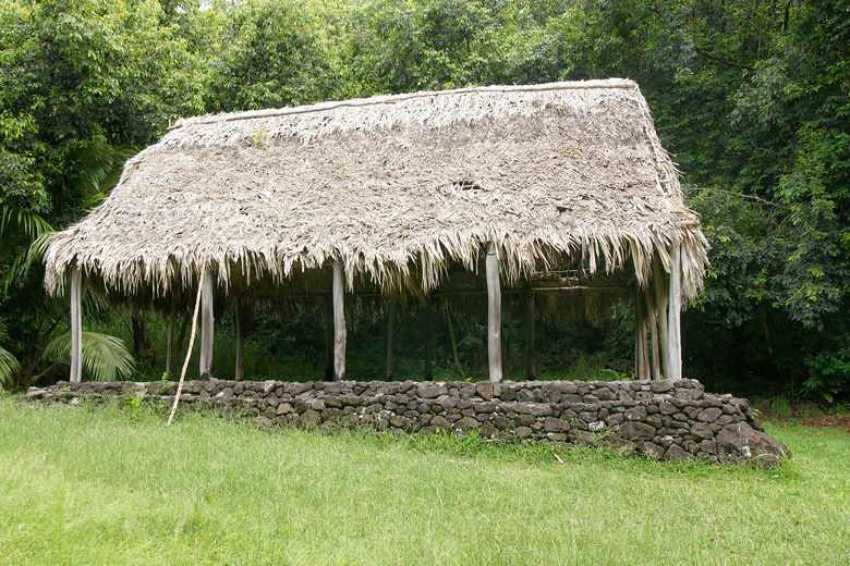
Hale Ku'ai
Next, we crossed the highway. It's only about 15 feet wide at this point. Traffic is usually light, but cars come in
from the right around a blind corner, so it pays to be cautious. After crossing the road we continued along the trail
on the other side.
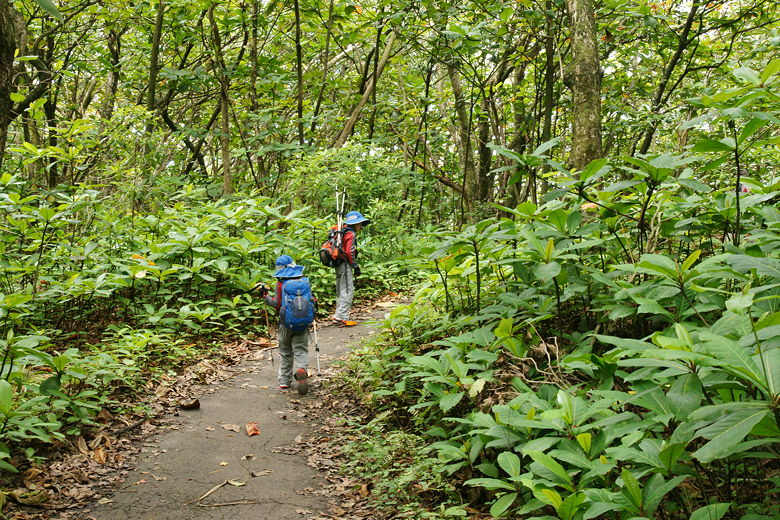
Trees and trail
The trail climbs gently, with the stream on the right mostly not visible through the trees. There is a side trail
which the sign says provides a stream overlook, but we decided not to take it. About a half mile from the highway
we reached the Makahiku overlook. Visibile from here is a tall waterfall in the distance, but the view is mostly
obscured by trees and bushes.
Obscured view of Makahiku Falls from the overlook
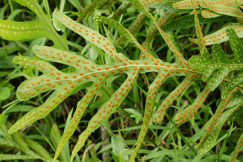
Dotted plant
Next we
passed through a gate, which I think is used to prevent pigs from going from one side to the other. We didn't actually
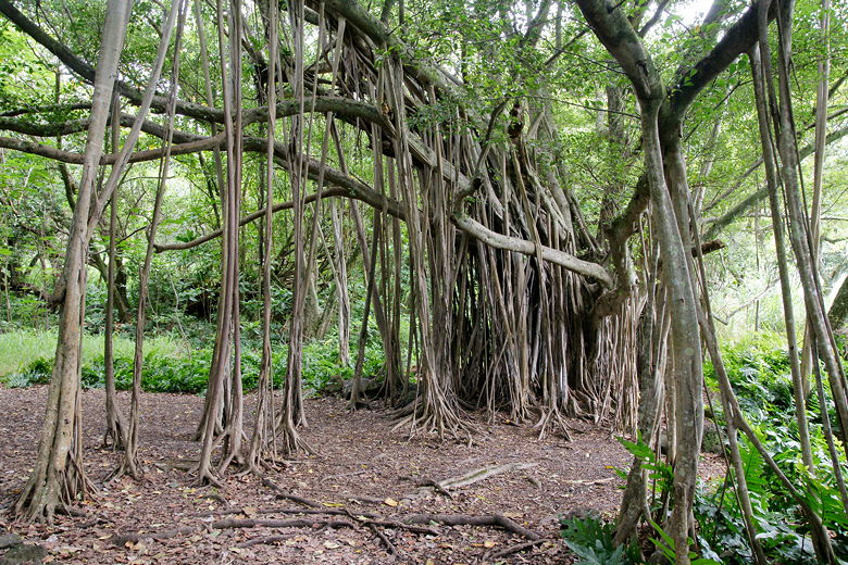
see any pigs, but we did close the gate behind us. We continued climbing up the trail, next reaching a large banyan
tree. It must have been over 100 feet wide.
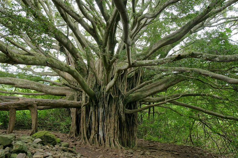
Giant banyan tree
We crossed over a steel bridge with a great view of two small waterfalls, best viewed from the center of the bridge. Almost immediately after, we crossed another bridge going back in the other direction.
Crossing a bridge over the stream
Two falls viewed from the bridge
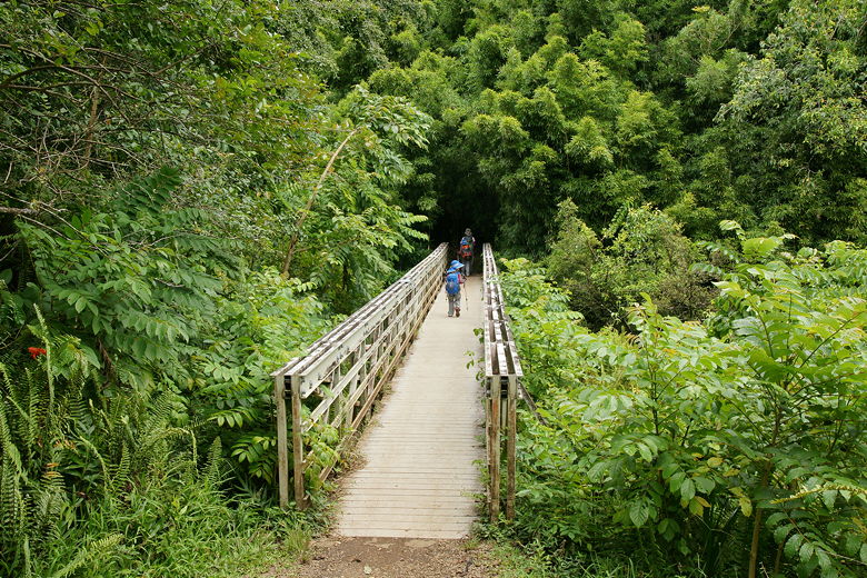
Next was probably my favorite part of the hike, and something I've never experienced before - a bamboo forest,
about 1.2 miles from the trailhead.
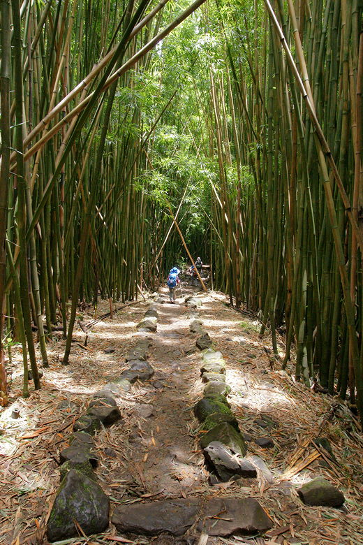
Bamboo trees towered 50 feet overhead, creaking occasionally in the wind. The bamboo trees are packed tightly together, forming an impenetrable mass. A 15-foot wide swath of trees had been cut out to make way for the trail. In the middle, wooden planks lined most of the route. Overhead, the bamboo trees leaned against each other, forming a teepee like structure. This meant that this was the darkest forest I've ever been in.
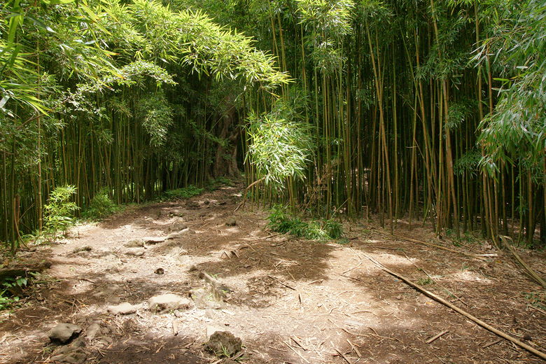
Entering the enchanting bamboo forest
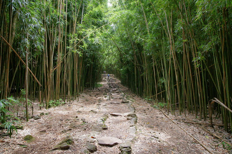
Bamboo forest
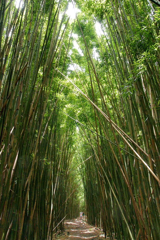
Bamboo trees bent over each other above us, making it quite dark in places
Some trail sections had just dirt and rock...
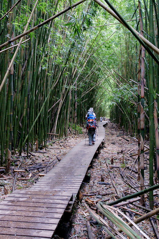
But much of the bamboo forest trail was covered with plank walkways
My only wish is that we could have enjoyed the bamboo forest with fewer people, as there were many people hiking through the forest in either direction. Even so, it was a beautiful place and I would return to do this hike just for the bamboo forest portion.
We emerged from the forest and reached the edge of the stream. Soon we could see not one but two towering waterfalls through the trees, one up ahead on our left and another to our right. We would only be visiting the one on the right.
We then had to cross the stream twice without the benefit of bridges. Rocks made the passing not too difficult for adults, but I had to carry my youngest child across one portion. The rocks are slippery, of couse, so I took off my shoes and socks and just walked in the water when I carried my son. On the return journey we discovered a better route slightly upstream which he could do on his own.
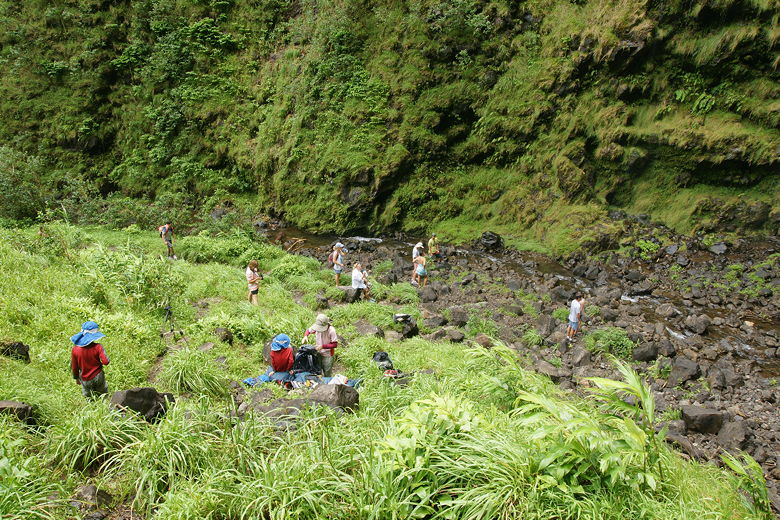
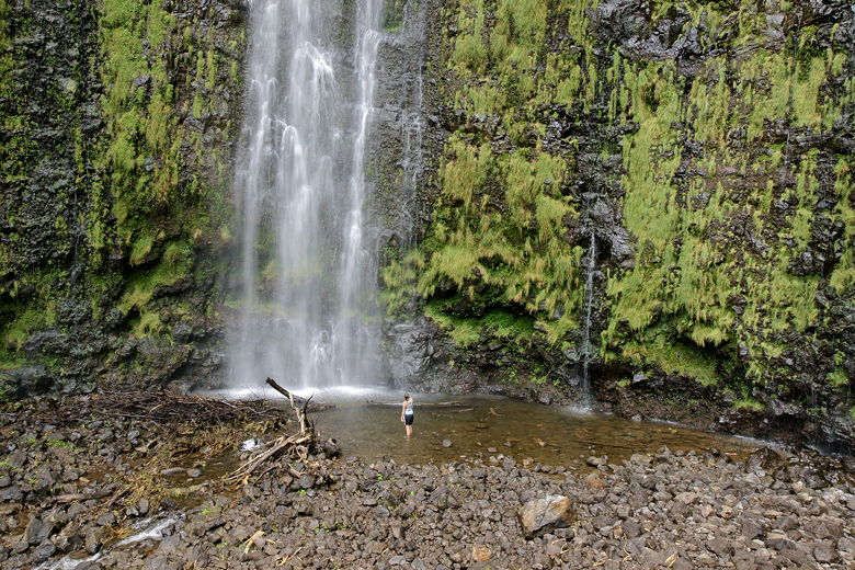
The second crossing was easier than the first, although again we found an easier crossing further upstream. Almost as soon was we made the crossing, we had a clear view of Waimoku Falls in front of us. The cliff walls surround the area, curving around on both sides. A pool sits at the base of the falls, and a pile of rocks in front of the pool. A sign warns of the dangers of falling rock in the area. We kept our distance, finding a nice perch for lunch on an elevated grassy area above the rocky section in front of the pool.
The skies were cloudy with the threat of rain, so I took pictures before eating lunch. Sure enough, just as I was finishing my lunch, it started to rain. We pulled out our rain jackets while others scrambled for cover under nearby trees. For a brief time we were the only ones there, until the rain stopped about 5 minutes later and the masses returned.
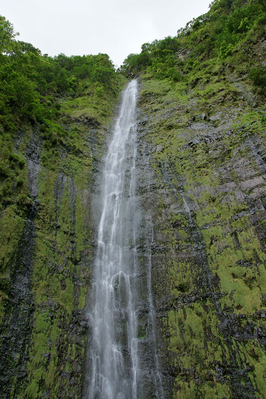
Waimoku Falls
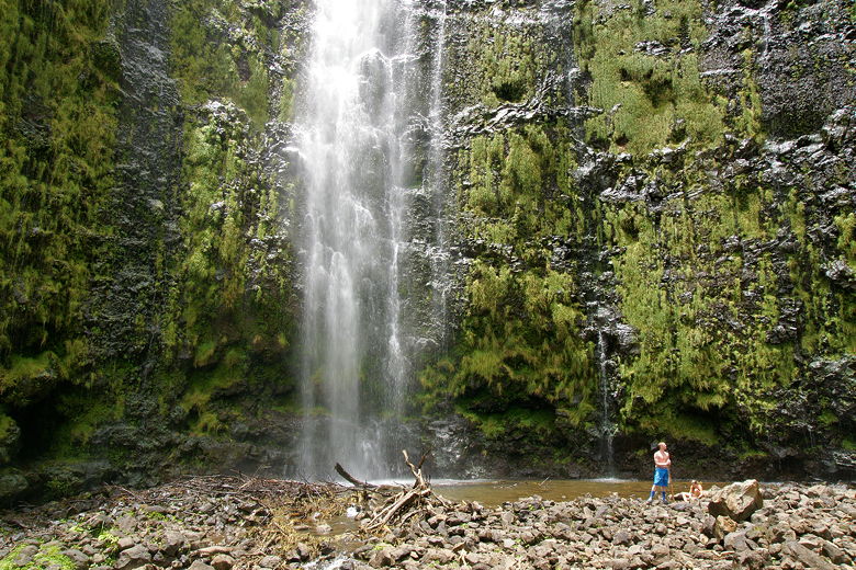
Waimoku Falls and Pool
Grassy area overlooking the falls
Waimoku Falls
Probably about 20 people were there as we packed up and started the return journey, back through the bamboo forest, past the banyan tree, and back to the parking lot.
It's a bit of a stretch to give this hike a 9 rating, but the bamboo forest is unique
among hikes we've done, so I wanted to highlight it. Whether the hike is a 9 or
an 8, I'd highly recommend it, even if you only want to visit the bamboo forest and not
go all the way to the falls (though the falls are not that much further).
| 

