|
We took our time getting ready after a late night, finally getting to the trailhead
around 11:30am. It was warm in the sun but chilly in the shade, where the occasional
breeze was biting cold. But it would warm up a bit more later. It would be in the 60's
and maybe low 70's today.
There are actually 3 trailheads here, and we actually stopped briefly at the wrong one
before I asked someone if they knew where the Duck Pass trailhead was; they pointed
up to the next parking lot. There were a handful of cars in the large lot as we
started our hike around 12pm.
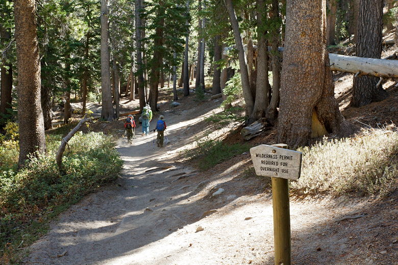
There's a bathroom with actual flush toilets at the trailhead. There's also a large
display with maps and descriptions of the area. Almost immediately after starting
the hike, there's a trail intersection; the trail to the right leads toward Emerald
Lake. We continued straight toward Arrowhead Lake. You could take the right trail and
visit tiny Emerald Lake as part of a loop; the trail eventually meets up with the main
trail between Arrowhead and Skelton Lakes.
Start of the Duck Pass trail
The trail then starts climbing immediately through the forest. There isn't much in the
way of views here. There is a glimpse of Lake Mary below (looking back over the parking
lot), but nothing really impressive.
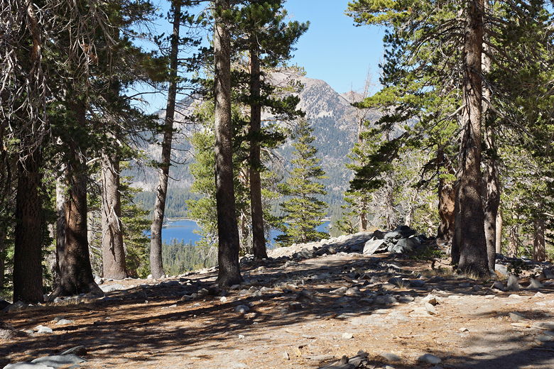
Looking back at Lake Mary
After about 0.7 miles, we saw a path leading off the main trail to the left. There was
no sign here. Based on the map and description it looked like this should lead to
Arrowhead Lake, but we eventually decided not to take it. I had read that there was
another path to the lake further on, and since we couldn't actually see the lake yet,
I didn't want to take an unsigned trail.
We didn't have to wait long until we reached a well-signed intersection, with a path
to Arrowhead Lake leading to the left. The trail heads slightly downhill, with
the lake clearly visible through the trees.
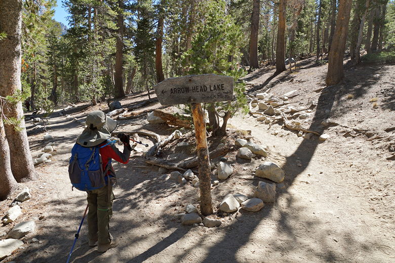
Trail to Arrowhead Lake
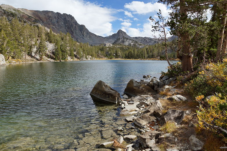
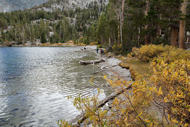
From a satellite view, the lake clearly looks like an arrowhead, but you can't really
tell from the shore. There were some yellowing bushes on the opposite shore, but not
much else in the way of fall colors. The lake is bordered on the east side by
a lightly forested mountain, while forest lines the western shore that we were on.
We were one of the only ones at the lake. There
were a few people at the southern end of the lake; they looked like they might be
fishing.
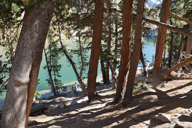
Descending to Arrowhead Lake
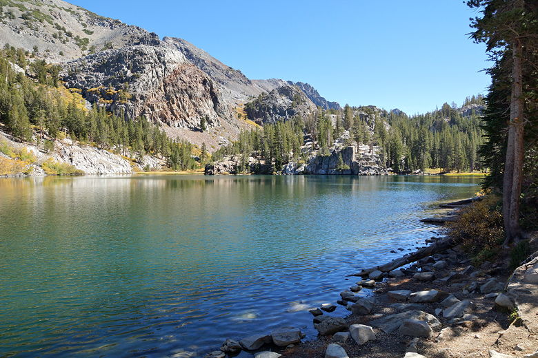
Arrowhead Lake
Arrowhead Lake
After a 45 minute lunch break, we continued along the Duck Pass trail. The trail
climbs a bit more, then levels off for a while. I kept looking for signs of the
trail to Emerald Lake on the right, thinking we might take it on the way back.
I saw one trail that looked like it might be the right one, but it wasn't obvious.
If you're planning to do the loop, it's probably better to visit Emerald Lake first
(instead of Arrowhead Lake), as it will be obvious once you reach the main Duck Pass trail.
Then you can visit Arrowhead Lake on the way back.
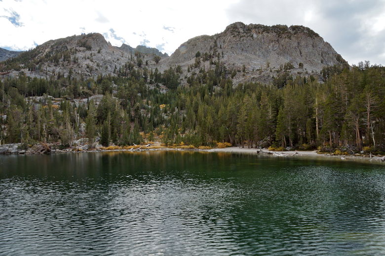
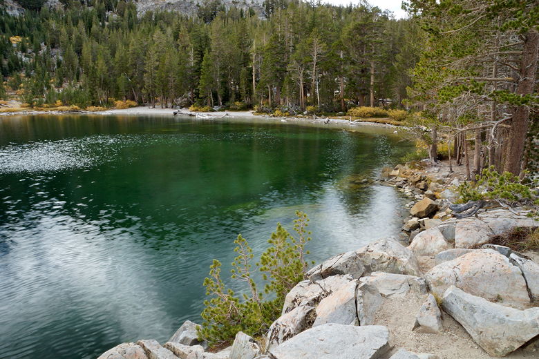
Soon enough we were at Skelton Lake. There's a little beach here, but I eyed a
little rocky peninsula on the left that I thought would provide some good views.
We walked over
to it. From there, we could see the "finger" of the lake on the other side (this is
clearly visible on a map). There were a handful of other people here, including some
fishing on the opposite shore.
While it had been almost cloudless earlier, passing clouds now started to hide the sun.
When we got to the peninsula, I happened to look at the lake when the sun was just out
but the clouds were reflecting in the water, getting an interesting abstract-looking
photo. It almost looks as if there's some milky substance in the lake until you realize
it's a reflection.
Clouds reflecting in Skelton Lake
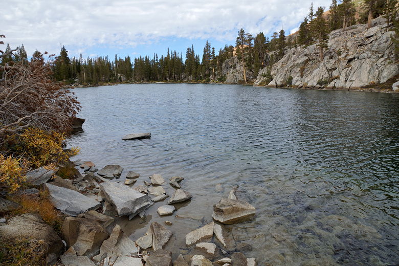
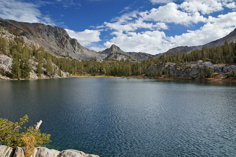
Although Skelton Lake is about the same size as Arrowhead Lake, Skelton Lake seemed larger
to me. Perhaps this is because we were on a peninsula in the middle of the lake. From
here we had nice views of the mountains to the south behind the lake. It is definitely
a more photogenic lake than Arrowhead Lake.
Skelton Lake finger
Skelton Lake
Skelton Lake
Western shore of Skelton Lake
Skelton Lake shore
After a shorter break of about 20-30 minutes at Skelton Lake, we returned to the main trail.
If you have more
time, you can continue along the Duck Pass trail to Barney Lake, much larger Duck Lake,
or even Duck Pass itself. We were just doing a short hike today, though, so we turned
around here.
Heading back toward the main trail
It was cloudy as we started the hike back, but it cleared up a bit and warmed up. The
hike back, of course, was easy. We thought about taking the trail to Emerald Lake,
but decided it wan't worth the possibility of getting lost since the trail wasn't
signed on this end. We simply went back the same way we went in, arriving back
at the parking lot around 4pm.
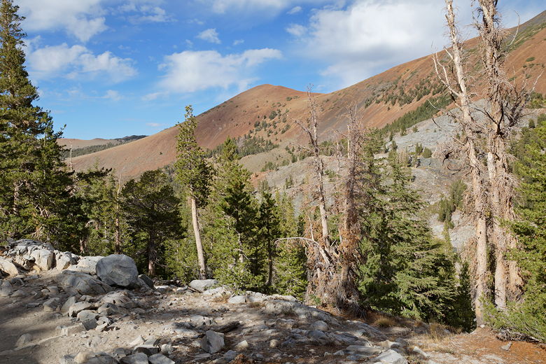
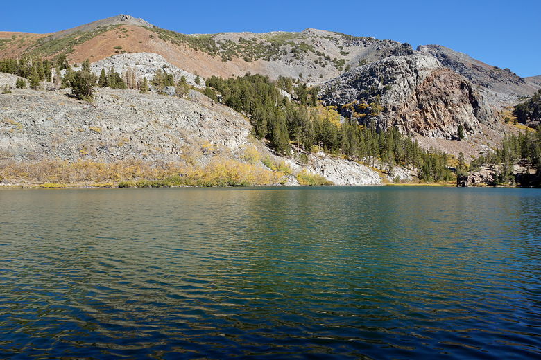
Mountains north of Arrowhead Lake
| 

