|
We woke up late today, after a mentally exhausting day the day before.
While we were getting ready, we were all feeling a little light-headed for
some reason, which didn't make any sense since we were at a lower elevation than
before (only about 8400 feet). Maybe it was the mosquitoes getting to us
(they were still active in the morning, though not quite as much as yesterday
afternoon/evening).
We finally broke camp at 11am, then started back up the 1600 foot climb toward Purple Lake.
As we climbed higher, we could see that the smoke from the fire we'd seen yesterday
had spread south into the Cascade Valley. It's a good bet that may have been the
reason we were feeling lightheaded earlier. As we climbed, though, we climbed above
most of the smoke and could breathe easier.
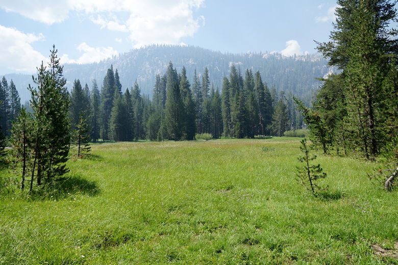
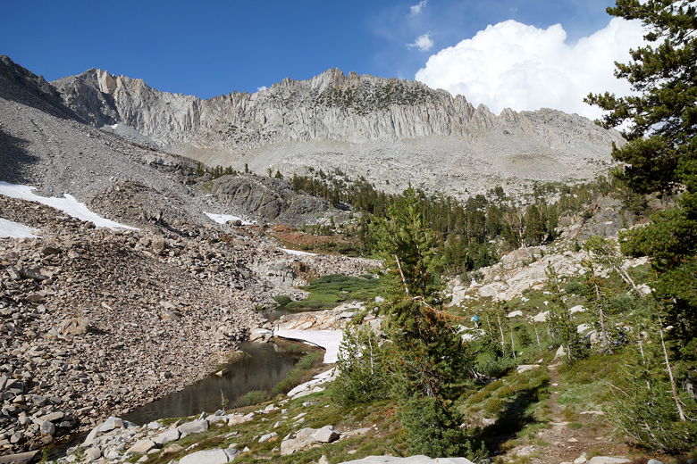
Cascade Valley meadow
Not surprisingly, we hadn't seen another soul on the trail down to Fish Creek, and
we didn't see anyone else on the way back up, either. Once we reached Purple
Lake, it was a different story of course. There is lots of traffic on the JMT,
and we saw it pass through as we took a lunch break by the lake. We also saw
a pack train led by the same people we'd seen on our way to Duck Pass back on Monday.
They were headed toward the trailhead back then, but now they were headed to camp
at Purple Lake. They passed by as we ate.
After our break we headed up the Ram Lake trail, which leads to most of the Purple Lake
campsites. There are a few sites here available to those JMTers willing to make
the short detour and small climb. We then came upon the horsepackers, who were setting
up camp. The trail went right through their camp. We mentioned we were heading to Ram
Lake, and the leader said that a guy he knew hadn't been able to get up there without
getting wet. He said the creek crossing came up almost to his waist. We made a note
of it, but figured at worst we could always camp near the creek.
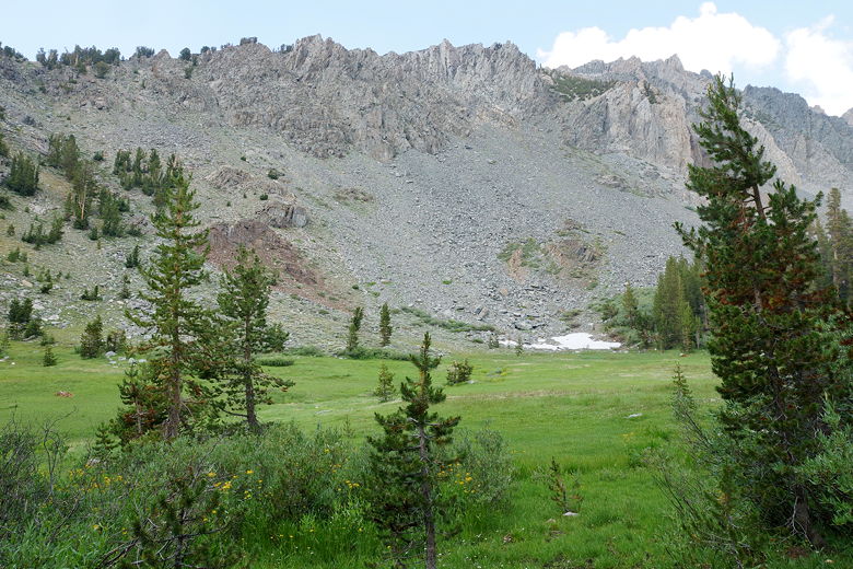
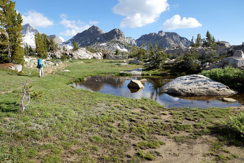
Meadow past Purple Lake
After the horse camp, the trail got really muddy. There were also a lot of sections
with downed trees. The trail appears on some maps but not others, and probably
isn't maintained as much as others (such as the JMT). We slowly made progress,
though, as the trail climbed slowly up, eventually leaving Purple Lake behind.
A couple day hikers passed us, probably on their way to Ram Lake as well.
Strangely, we never saw them again. It's possible we lost them at one of a few
unmarked forks in the trail. I'm guessing they mostly all end up in the same
place, but through different paths.
Eventually we reached the creek crossing. We tried to find a path that didn't involve
getting in the water, but couldn't find one. It wasn't a bad crossing, though - it
only ended up being knee deep at worst. We all made it across without incident,
though of course this did slow us down as we had to stop and put our water shoes
on. The creek was narrow enough, though, that I simply threw our boots across to
the other side.
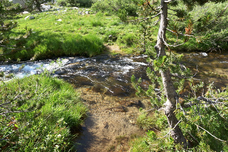
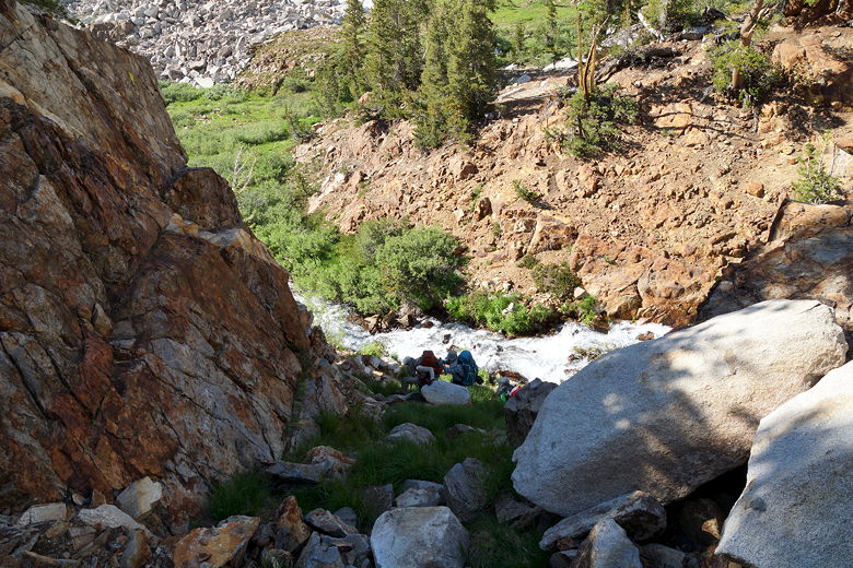
Purple Creek crossing
Purple Creek
From there the trail follows the creek upstream. We followed it up a narrow gorge
and then came to a place where we'd have to cross the creek again (if you're wondering why
we had to cross the creek twice, the reason is a large talus field on one side of
the creek, that would be difficult to navigate). Here, the creek was narrow, but the
terrain was steep and the water was gushing down. There was no way we could safely cross.
We back-tracked a bit and climbed out of the gorge. We then went further upstream until
we found an easy crossing - one we could simply rock-hop across.
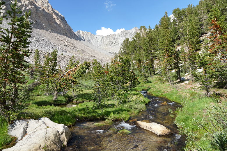
Climbing toward Ram Lake
Climbing out of Purple Creek gorge
Heading toward Ram Lake
Having the GPS here really helped, as I could tell we were going in the right general
direction, even without a trail. Soon enough I saw the establshed trail to our left,
and we rejoined it. Soon after, we reached Lower Ram Lake. Well, on the map Ram Lake
appears as three separate lakes, though they are sort of connected by streams. I'm
calling the first one the lower one (and it is slightly lower in elevation then the other
two).
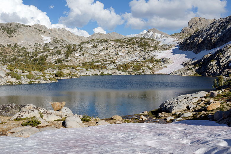
Lower Ram Lake
Snow field next to Ram Lake
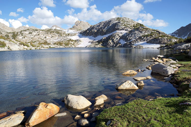
Lower Ram Lake
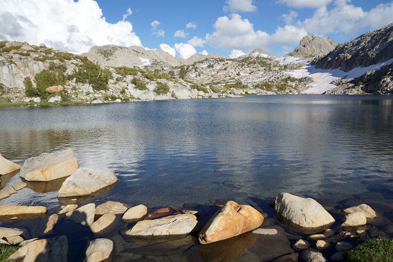
Lower Ram Lake
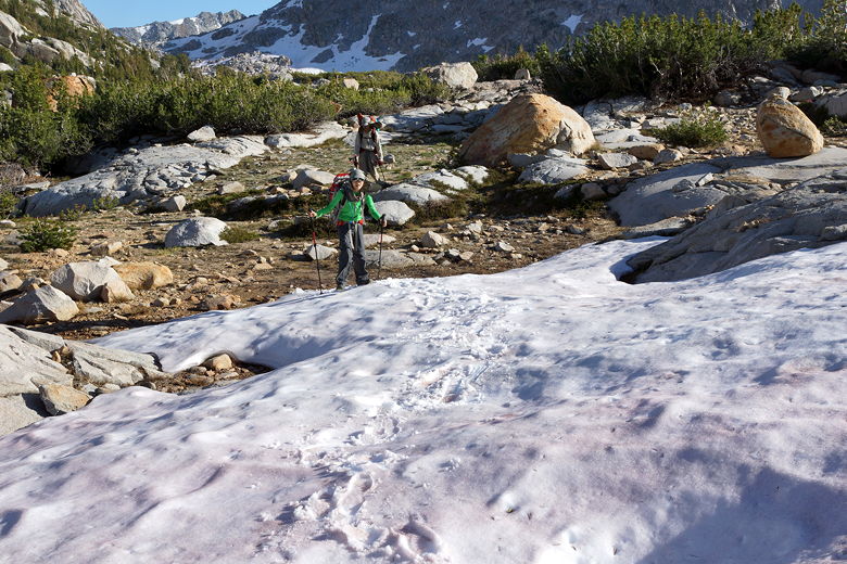
We decided to head for the largest of the three (I'm calling it Upper Ram Lake). We
crossed a snow field next to the lower lake, then scrambled over some rocks and made
our way over to the upper lake. Despite it being only about 3.5 miles from Purple Lake
to Ram Lake, it took us almost 4 hours to get there, with the creek crossings, the back
tracking, the scrambling, and route finding. But when we did get there, we had
the lake all to ourselves (we probably had all 3 lakes to ourselves), and we found a
really nice campsite overlooking the lake.
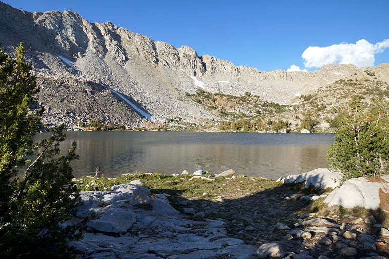
Upper Ram Lake
At this higher elevation, the mosquitoes were not nearly as bad as at Fish Creek, though
there were still a few. There were, on the other hand, thousands of gnats which
we could see hovering near every tree in sight.
|


