|
It was a brisk but clear fall morning when we arrived
at Laurelwood Park. There's a playground, some picnic tables,
and restrooms here. Since it was only 9am, there weren't
many people yet.
We immediately exited the park at Shasta Drive, but then
just as quickly turned right onto the single track
Creek Overlook Trail. While the name implies there's a
view, there's not much to see from the trail,
although there are some pretty forested sections.
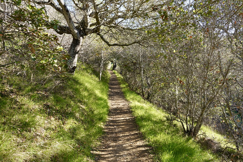
Creek Overlook Trail
We reached an intersection and turned right onto the wide
Shasta Trail. I wasn't paying enough attention and we
inadvertently turned right onto the Tenderfoot Trail.
We went almost all the way back to the playground before we
realized this, and turned around. Back at the end of
the Shasta Trail, we found the trail we should have taken:
leading straight from the Shasta Trail was a tiny, almost imperceptible
trail leading uphill. It was muddy and steep, but we started
up it.
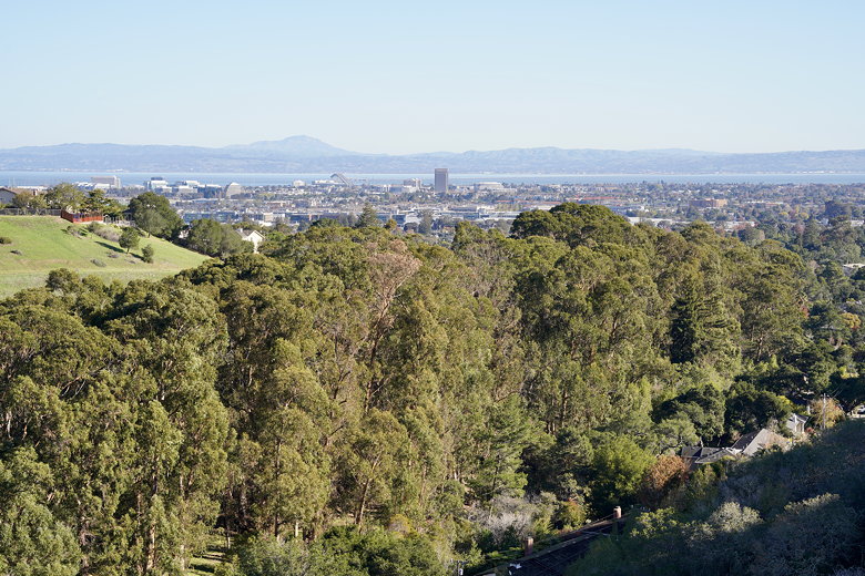
It's muddy and steep for a while, but the higher you climb the
better the views. We had great views of the San Mateo bridge
and surrounding bay. The trail levels out a bit and widens.
We noticed trails leading downhill to the right, but we
passed them, continuing on to the top. There were a couple
other hikers at the top. From here, we had great views all
the way to San Francisco.
San Mateo and the Bay
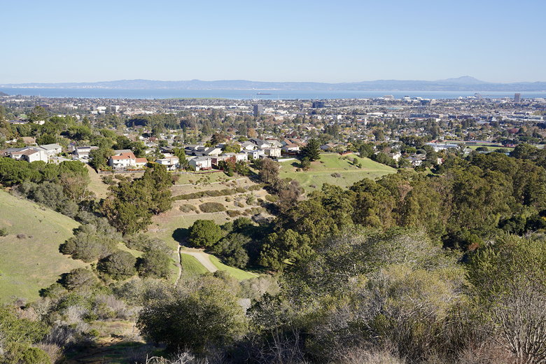
Another view of the Bay
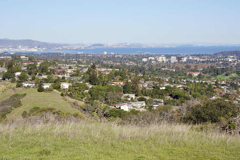
View of San Francisco from the top
After enjoying the views, we turned around. We had thought
we were at the end of the Sugarloaf Spur Trail, but in fact
we weren't. But we were at the top; I'm not sure what's at
the end of the spur trail. There are several unmarked trails
and faint trails in the area, so it's a bit hard to tell which
one you're on. We went back and turned left where someone
had written in chalk/paint "T/E". Not sure what that
meant; maybe "trail end?" In any case, it turned out to be
the Saddle Trail. It leads steeply downhill, but at least
the trail is wider than the way we took up.
At the bottom, we turned right into the forest and onto the Salson Trail. You could
take the Salson Trail all the way back to the playground.
Instead, we turned left onto the Box Canyon Fire Road. I can
say that because I'm looking at a map afterwards, but I don't think
there was any sign with that name.
A few mountain bikers passed us in the opposite direction. A short
time after that, the trail was blocked by a couple branches. We
squeezed our way under them, wondering how the mountain bikers got
past.
The trail becomes the Skymont Trail. At the time, I thought we were
on the Cross-Trail, so when we saw
a trail on the right, I thought that was the Skymont Trail (which in
fact we already were on). So we went past that trail, following
some more chalk signs on the ground and exiting the forest to the right.
We could see houses now, but no trail. We eventually turned around
and headed back to the trail, and took the turn we hadn't earlier,
the Poison Oak Alley trail.
The trail curves through the forest, eventually rejoining the Salson Trail.
We turned left and were shortly back at the playground, where the park
was now full of people. In summary, this is a short hike with nothing
of particular to note except for the great views from the top. Just
make sure you're ready for some steep (and muddy, depending on the season)
trails to get up there.
| 

