|
The first excitement of the day was trying to get to the parking lot. After taking Sharp Park Road
down the hill, I turned right at the T-intersection and then proceeded to miss the right
turn onto Highway 1. So I essentially had to make a U-turn. Then, after going
down highway 1, you have to make another U-turn near Reina Del Mar. Finally, when
I went to make the right turn onto Mori Ridge Road, I didn't see any signs for it. I
was a bit confused at first. It looked like a private road, with someone's mailbox here, but
it actually isn't. You can also see a small trailhead on the left at the entrance, though you
shouldn't park right here. I finally went up the road and parked in the large lot, where
there were already about 8-10 cars parked in the mud.
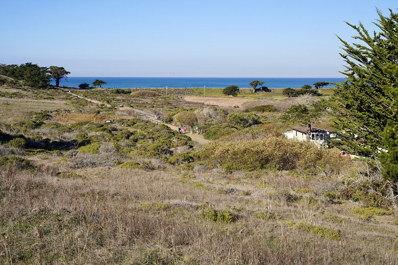
Since this is a loop hike, you can do it in either direction. I'd decided to do the hike
counter-clockwise so that I'd visit the ocean part first, thinking I'd get better
lighting in the morning for photography. So after I parked the car, I walked back down
the road and turned right onto that little trail I'd seen on the way up.
I should probably mention in advance that I was basing my route on the AllTrails app.
It has its uses, but it has its quirks as well. One thing about this route is that
it's not all trail hiking. There are some sidewalks and roads as well. After a very
brief trail section, I now found myself on residential streets. Two blocks later,
I turned left to walk in a tunnel underneath Highway 1 (much safer than trying to
cross at Westport Drive). I did have to wait a few seconds for a golf cart to drive
out of the tunnel (there's a golf course straddling Highway 1 here).
At the other end of the tunnel, I turned left and continued on residential streets
(Bradford Way) until I came to the Mori Point trailhead. There's a small parking
lot here, but most cars were parked on the side of the road. Even that was mostly full.
After checking out the map, I decided to stick with the AllTrails route, which took me
further along Mori Point Road before turning right onto the Upper Mori Trail.
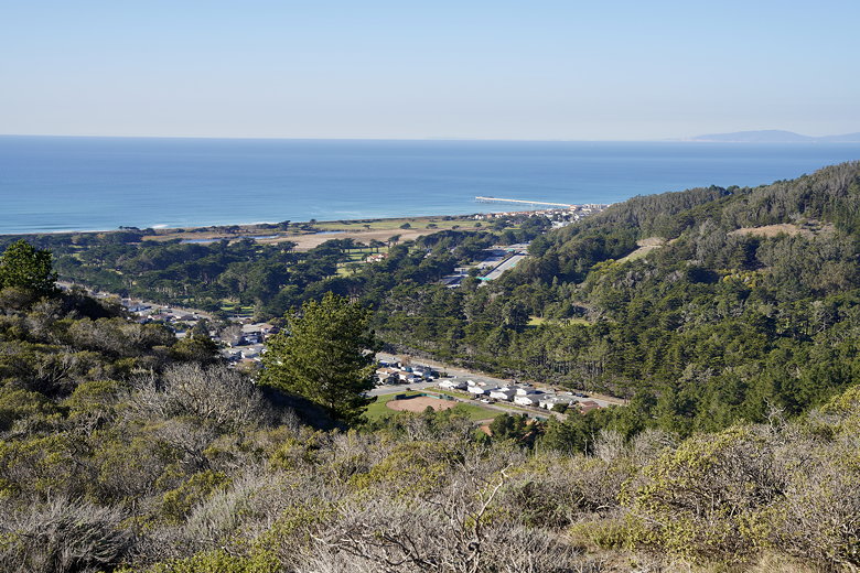
Lower Mori Point Trail
There isn't a ton of difference between the two trail options, but the Upper Mori Trail
is further away from the houses, and has a slight climb. The other "trail" is a wide
mostly flat dirt road that basically goes all the way to the coast. I stayed on the
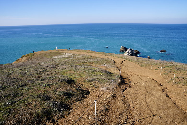
upper trail, keeping left at the junctions until I reached the top. Here,
there's a staircase that leads down to the right, down to the lower trail. Also in that
direction you can see the Pacifica Pier.
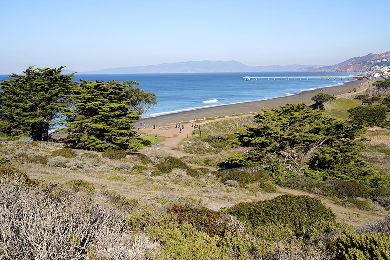
Pacifica Pier and coast
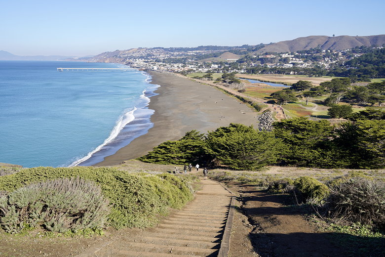
Steps leading down from near Mori Point
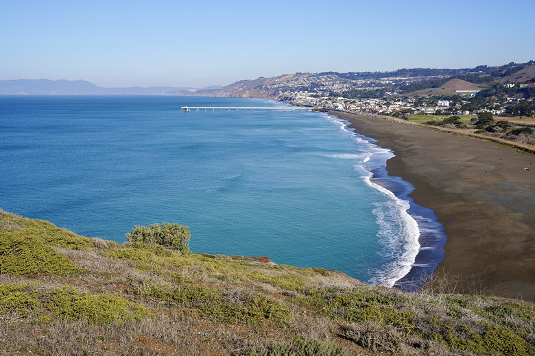
Pacifica Pier and coast
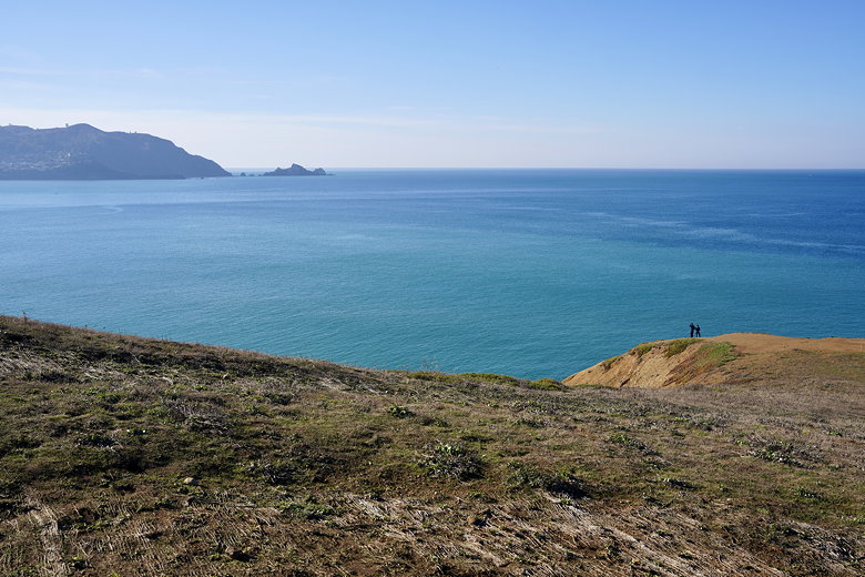
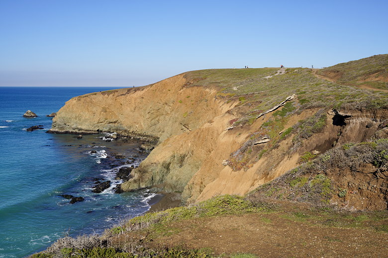
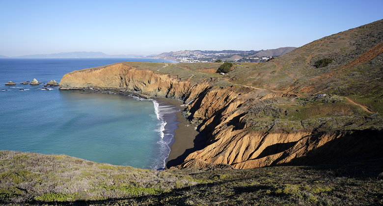
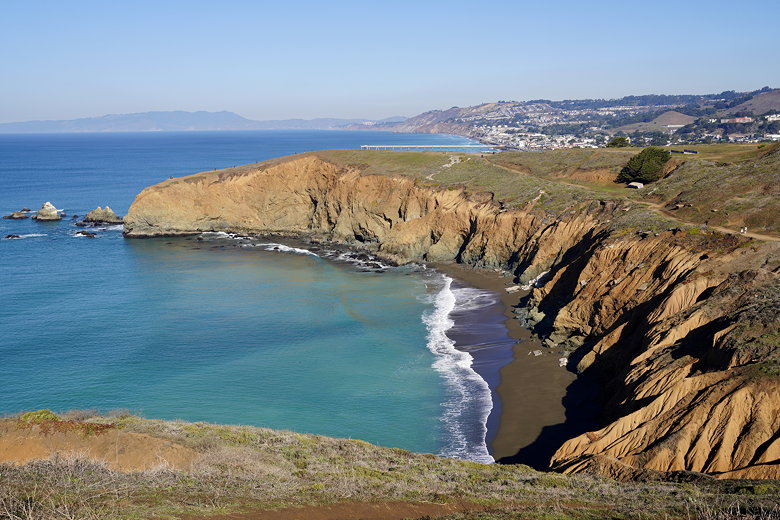
Passing the staircase, I kept going to reach Mori Point. The trail descends a bit and
provides great views of the ocean and some small rock islands nearby. Once you reach
the "end", there are no railings or anything. You have to decide for yourself how
close you want to get to the edge. I stayed firmly away from the edge (did I mention
I'm scared of heights?), though I ventured far enough to get some decent pictures
(I think).
Approaching Mori Point
Trail to Mori Point
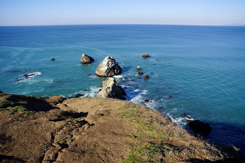
Rock islands off Mori Point
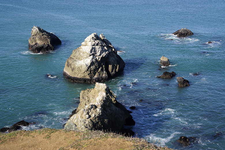
Rock islands off Mori Point
After taking some pictures, I turned around and headed back up, then turned right onto the
Mori Bluff Trail. At least that's what I can see it's called using Google Maps; I don't
think there was any sign there. This trail is mostly flat, with nice views looking back
at Mori Point. There are some concrete structures with grafitti and artwork.
After a flat stretch, the trail climbs up steeply (in the mud at this time) to another
overlook.
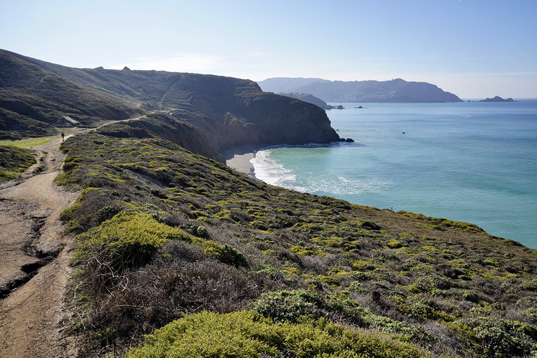
Looking south along the coast
Looking north toward Mori Point
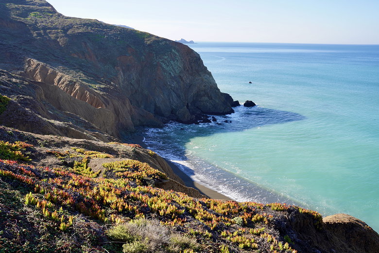
Invasive ice plants
Looking north toward Mori Point
Looking north toward Mori Point
Looking north toward Mori Point
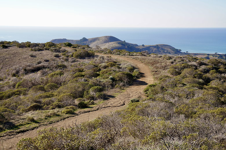
From here, there's a patchwork of use trails leading south along the coast, with some
trails leading inland. I tried to keep going south as much as I could, though some parts
are fairly steep. I finally found myself in the wrong spot; I must have missed a use
trail heading south and headed inland instead. I could have tried heading back up to
find it, but I figured the wiser course of action was to just keep heading inland, join the
bike trail, and use that to head south. Which is what I did (although the detour probably
added perhaps half of a mile or so to the hike).
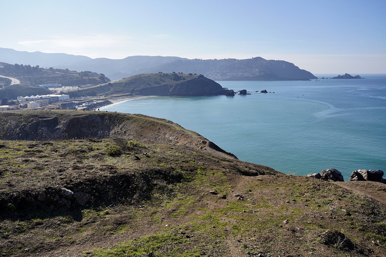
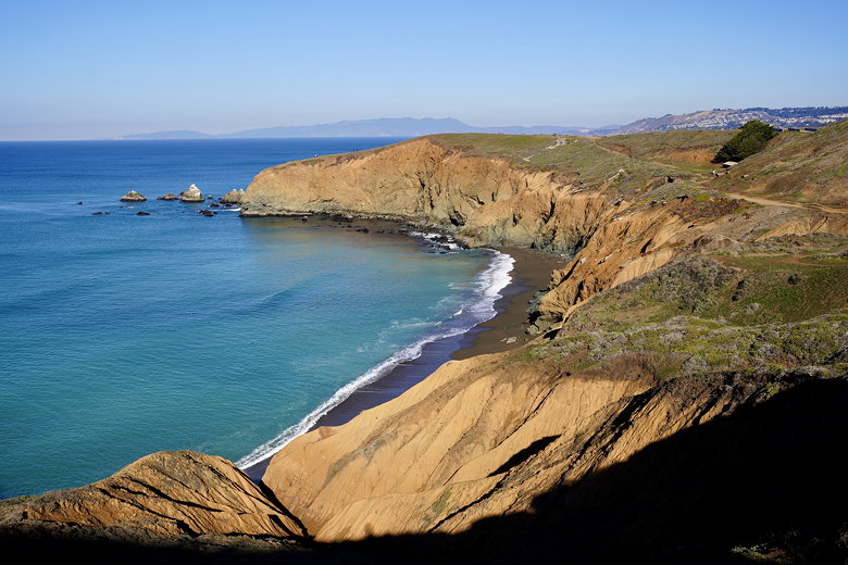
Looking south along the coast
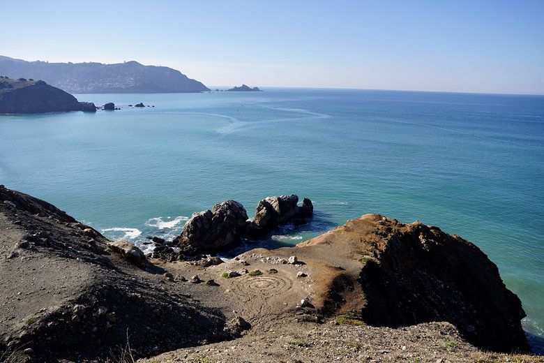
Looking south along the coast
I walked through the parking lot to the Rockaway Beach Trail, seeing a couple surfers
in the ocean to the right. Then I turned left onto Rockaway Beach Ave. and crossed
busy Highway 1 again (there's a stoplight and crosswalk). Next, I made my way over to
Harvey Way and then eventually to a church parking lot with "No Trespassing" signs.
There didn't seem to be anyone here, so I didn't feel too about the signs,
and I saw a couple hikers walking down toward me. But I was confused, because when I reached
the parking lot I couldn't see where the trail was. Eventually I found it at the far right
corner of the lot, though it wasn't marked, and it was very faint.
I think to be respectful of the church, it's probably better to, once you've crossed
Highway 1, take Fassler Ave. to Rockaway Beach Ave. to Donaldson Ave. At least Google
Maps shows you can find the trail from the end of Donaldson Ave. Though it still skirts
the edge of the church property (but at least you won't be walking through their parking lot). And
caveat to the reader: I haven't actually done that route, so I can't guarantee it's
the best way. If anyone else has, please feel free to let me know if it's a terrible idea.
In any case, now that I was on the trail, I followed it steeply uphill. And I mean steep.
The kind of steep that makes you wonder if it's actually a trail (especially since it's
pretty faint). Eventually, though, I made it up to more well-defined parts of the
trail. Though it was still steep and narrow. This is the Farallones View Trail, and as you
get higher you do have some views back toward the ocean. However, as you're hiking up you
should be hyper-aware of mountain bikers. As I mentioned, the trail is steep and narrow,
so they'll be coming down with speed. I happened to be near the side of the trail as
one approached around a blind corner and was able to step to the right, slightly off trail,
to get out of the way. The rider mentioned there were more behind. There were about 6 of
them, so I
waited until they all passed before I proceeded. That kept me on edge the rest of the way.
They were all perfectly courteous, but it just seems like a dangerous environment.
I encountered a couple more mountain bikers passing me before the trail widened and flattened
out a bit so I could breathe easier. I passed a lot of hikers coming in the opposite direction,
as well. My perception is that most people were doing the hike clockwise, though I can't
say for sure (and I don't know if they were doing the loop). And I can understand not wanting
to go up those steep sections I did, but then again I probably wouldn't want to descend them,
either.
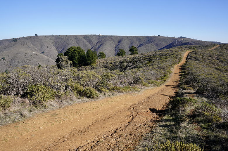
Climb up toward Sweeney Ridge
Next, I came to the Portola Discovery Site. There's a plaque here (under maintenance at the
time), and some interpretive panels. There are also great views across the bay to Mount
Diablo. I passed the restroom next to the trail, then passed Sneath Lane and continued on
the Sweeney Ridge trail, which is a paved road at this point. The road is probably used for maintenance
vehicles (for the bathroom, and the big round structure with antennas in front that I
shortly passed).
Soon, I reached the old Nike missile site. There aren't any buildings left here, though
there are a few concrete footprints. I settled down on one of them to have lunch. From
here I had great views. Facing north, I could basically simultaneously see the Pacific
Ocean on the left and San Francisco Bay on the right. The SFO airport was clearly visible.
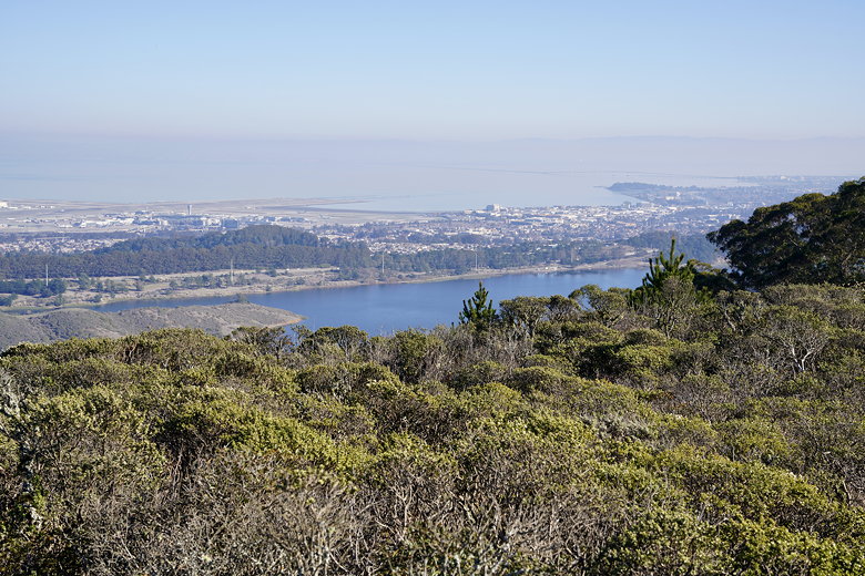
San Andreas Lake
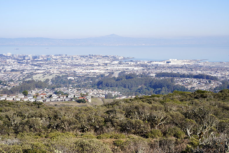
View of Mount Diablo
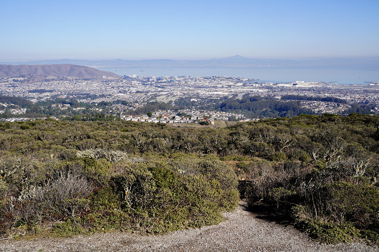
Peninsula, Bay, and Mount Diablo
After lunch, I continued along the trail (now a dirt road), which starts descending toward the ocean.
A fork to the right would take you to Skyline College (where I'd hiked from back in 1999),
so I stayed to the left. There are one or two stretches which are fairly steep downhill,
but the trail is wide so I didn't feel threatened by the possibility of downhill mountain bikers behind me.
I do wonder why none of the trails have any switchbacks, though.

Mushroom next to the trail
Return trip
Return trail
Back at the parking lot, it was much warmer and busy now, as the orchid garden was open.
If I had to do the hike again, I think I'd probably still stick with counter-clockwise.
However, another option would be to just split it into two hikes. Do Mori Point as one
hike and do Sweeney Ridge as a separate hike, starting from any of three different
trailheads (and avoiding the steep section down to Rockaway Beach, which doesn't add
much to the hike). Still, loop hikes are nice and convenient, so if you want to stick
with a loop hike, it's not the worst; just be prepared for the things I mentioned.
| 

