|
Jean and I headed up Highway 1 a little later than we'd hoped. We wanted to do the Alamere
Falls hike and then visit the nearby oyster farms afterward. However, things would conspire
against us. First of all, after heading across Highway 1 toward Stinson Beach and then past
the lagoon, we missed the turnoff for Olema-Bolinas Road. After traveling several miles
past the exit we turned around and missed it again. Finally, I took a leap of faith and
turned onto an unmarked road. This turned out to be the correct road. For those of you
attempting to do this hike, take the road just north of the lagoon. Or take the signed
Horseshoe Hill Road, which will take you to the right place.
After swearing to no one in particular for not putting a sign for the road, we realized
we wouldn't be able to visit the oyster farms afterwards. So, there being no rush we
stopped and paid $2 to gather some organic food (mostly salad fixings) from a sort of
mini-farmer's market. Strangely, they had dozens of bags of Acme bread spread out on
the ground.
We also stopped by the Las Baulines nursery. They have "plants for the coastal climate",
including some very beautiful Japanese maple trees. We picked up some seeds and a
few small plants before continuing on our way to the Palomarin Trailhead.
The road turns to dirt (another surprise) for the last mile or two before the large dirt
parking area at Palomarin. The lot was nearly full, but we managed to find a space.
It was 12:30 by the time we started our hike, up the dirt road above the parking lot.
The trail heads through a pleasant eucalyptus grove. One interesting thing I noticed
was that there were several large trees which looked like several trees growing on top of
each other, branching out from a giant trunk. Surrounding them were smaller, younger,
rail-thin trees -- a stark contrast to the older trees.
After the eucalyptus grove we started to see various wildflowers, including Indian
paintbrush, lupine, and poppies. We also saw cow parsnip, horsetails, and ice plant.
We also saw tons of people. I'm guessing there were as many as 200 people hiking the trail
with us this day. We seemingly ran into all of them at one time or another. At one
point later in the hike, we stopped so I could take some pictures; while we were there,
a pair of hikers passed by us every 30 seconds. And when we finally started hiking again,
another pair of hikers could be heard behind us. This is my biggest complaint with this
trail -- the number of other people.
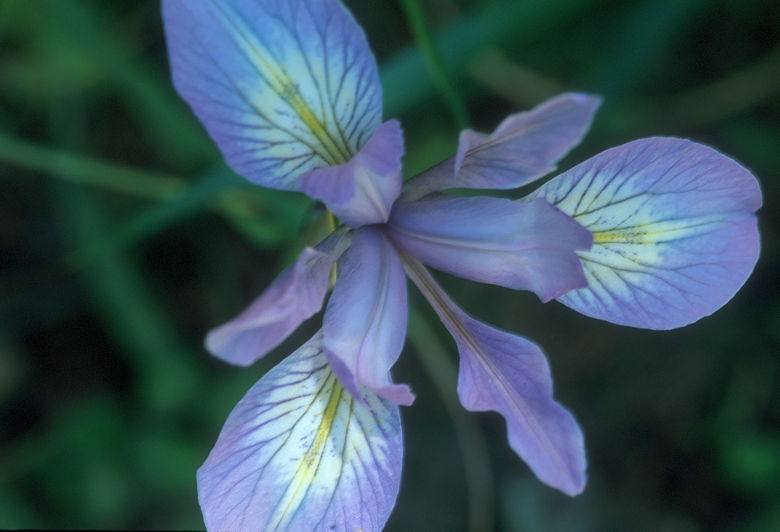
Iris
We continued along the trail, which zig zags a couple hundred feet above the coast.
A short distance from the trailhead, we were hiking out in the open and soon had views
over steep cliffs down to the ocean. After paralleling the ocean for about a mile, the
trail heads inland and upward, climbing through a rocky valley. Shortly after passing
a sign which told us we were 2.2 miles from the trailhead, we reached a nice shaded spot
above a large lily-covered pond. We stopped here to eat while more hikers passed by along
the main trail.
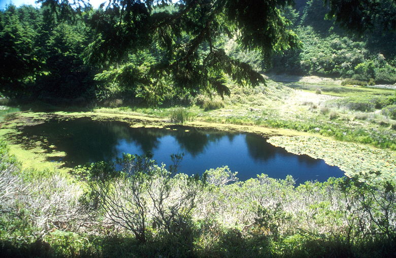
Pond near our lunch break
After lunch we continued along the trail, which headed through dense green vegetation
and then passed Bass Lake -- a large lake good for swimming. We'd see a dozen or so
people swimming and playing in the lake on the way back. While other groups detoured
to the lake, we continued up past the lake, up to a ridge where we could see the larger
Pelican Lake. Along the way we passed a sign telling us we were 3.1 miles from the trailhead,
meaning we were only 1.1 miles from the falls. This was a lie.
After passing the lake, we were out in the open again. We saw birds soaring overhead.
Closer at hand, we saw unsigned spur trails. Unsure, we passed them by. We continued
on what we best guessed was the main trail, which started to head down and, promisingly,
mostly westward toward the coast, where the falls are.
We descended and saw a rabbit scurrying about in front of us. It stopped while we took
pictures before bounding away. Two hikers passed us (they'd passed us before). Later,
we saw them talking to two other hikers coming in the opposite direction. They talked
a bit before parting ways, at which point we came to the two hikers coming at us. They
asked us if we knew where Alamere Falls were. This is not the question I'd wanted to
hear, since that obviously meant they hadn't seen them yet. At this point another large
group of hikers was coming in the opposite direction. We all gathered together and one
person said that the only way to get to the falls was to go to Wildcat Camp and then
backtrack along the coast. This would make the hike a 13-mile round-trip, rather than
the 8.4 mile trip we were expecting.
We ventured on for a bit before deciding we'd had enough. While the four original hikers
we saw kept going, we turned around. We stopped at a bridge over a creek. I'm guessing
this was the source of the falls, but I don't know. While we were there, more hikers
asked us if we knew where Alamere Falls were. And then two of the hikers we'd seen earlier
passed us by -- apparently they'd finally given up, as well.
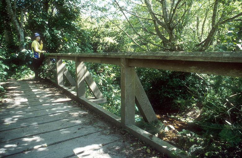
Bridge over Alamere Creek
On the way back I stopped and saw 3 people sitting
on a ridge overlooking the ocean. I assumed they were looking at the falls, but I have
no way of knowing. Nor do I know how they got there. We shortly found a trail which
could lead there, but it was well overgrown and not very inviting.
We continued on the trail, back past Pelican Lake, and Bass Lake. We stopped again
at the pond for a break. While we were there, yet another group of hikers asked someone
where Alamere Falls were. I thought to myself -- none of these people are going to find
the falls.
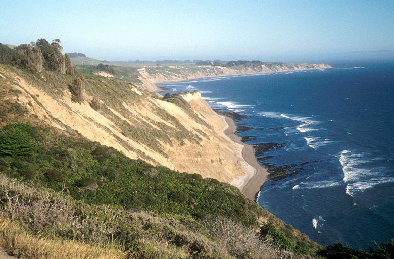
View of the coast on the way back
We enjoyed the views of the late afternoon sun shining on the coast as we walked back.
Near the beginning of the trail I looked at a map display. It didn't help much, as it
said Alamere Falls was 4.2 miles away, but didn't actually display any trails going there.
My guess is that there's no official way to get there, and that there are overgrown trails
which may or may not lead there. It seems misleading and possibly dangerous for an
official-looking map to have an official mileage (4.2) to a destination which has no
official route. Either the route is extremely obscure, or the route is really via
Wildcat Camp, in which case the distance is really more like 6.5 miles , not 4.2. [Note: since I've
done this hike, I've heard that they've now placed a sign showing the way on the spur trail
to Alamere Falls, so you should have better luck.]
Back at the half-full parking lot, we ended our hike. We were disappointed not from
missing the falls, but from the hordes of people trying to find it. The interesting
thing is that we've been on much prettier trails with far fewer people. My guess is that
there are legions of people living in San Francisco who never venture south of the
city. Their inclination is that to go outdoors means to drive across the Golden Gate
Bridge. Maybe I should stop saying anything and let them have their delusions so we
can have our peaceful hikes south of the city.
Post-hike note: I have been told by numerous people that the trail has since been
well-signed, and that Alamere Falls itself is a sight to see. So perhaps I'll try
again in the future. On a weekday if I can help it...
| 

