|
Jean, Jennie, Judy, and I met at the parking lot next to Grant
Lake on Mt. Hamilton Road. On the southwest side of the road lies
the main park entrance, and hordes of mountain bikers. But on
the northeast side, where we were, lies beautiful green rolling
hills, sparkling yellow and green trees, and a bit of solitude.
We left one car there and drove a little over a mile on Mt. Hamilton
Road back the way we came, and parked near the White Barn. It
was nearly 11am by the time we got started, and a layer of fog
and clouds still hung over the area.
After hopping over the gate, we hiked along a private dirt road
(accessible to hikers) which passes by the White Barn. We soon
had a nice view of a pond and the fog clouds hovering over the
hills. A half dozen cattle gazed at us as we stopped to enjoy
the view. Then we continued on the downhill trail, winding our
way north.
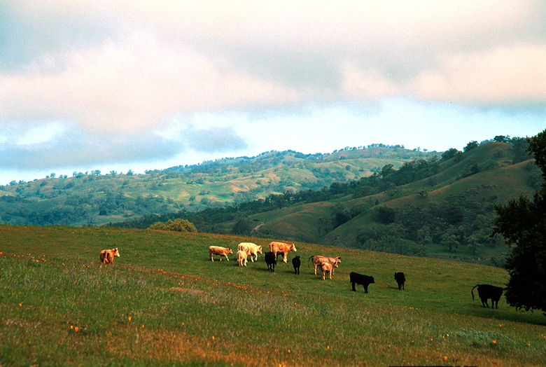
Cows among the poppies
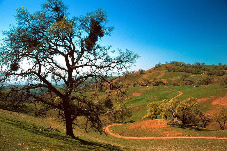
I was surprised to see moss hanging from tree limbs. It's something
I figured I'd more likely see in a rain forest than a place which
would be completely brown in the summer. It was actually relatively
lush -- very green grass interspersed with pockets of oak and
other trees of all varieties (I can't identify them myself, but
the book says sycamores and alders).
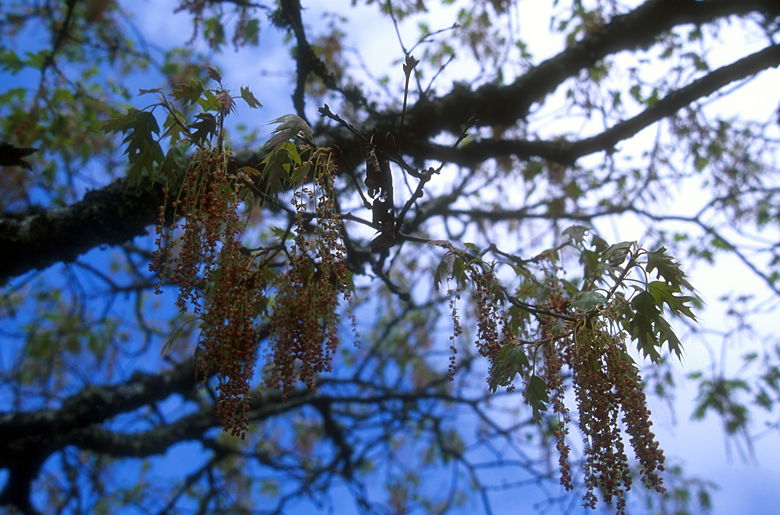
Berries in a tree
Almost the entire hike consisted of walking on dirt roads. Fortunately,
we didn't see many bikers. I had thought that the private road
was off-limits to bikers, but we did see one, and I never did
see a no-biking sign in the opposite direction (although there
was one at the front gate we hopped over).
The trail didn't stay downhill for long. After about a 300 foot
descent, we crossed Arroyo Aguague and started climbing. And I
mean climbing steeply. In places the grade is over 30%, though
these stretches are very short.
We reached a gate and turned right, hiking roughly parallel to
a fence. We were now on the Washburn Trail. After much climbing
we reached a nice spot for a break -- a grassy hillside underneath
a single large tree (well, such places were everywhere). We could
see the White Barn far below. Downtown San Jose peeked through
the haze below.
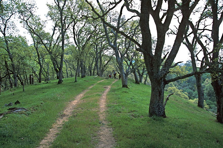
Trail through the trees
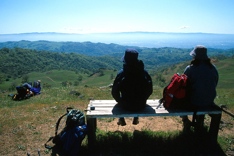
We now continued our climb, this time up a series of false summits.
We passed 4, maybe 5 or more false summits until we finally reached
a ridge topped with a perfectly placed wooden bench. This was
our lunch stop. By this time, the clouds had burned off and we
had great views. From here, we had a commanding view of the area,
including the Santa Cruz mountains peeking over a layer of clouds.
Behind us, Lick Observatory loomed on top of Mount Hamilton.
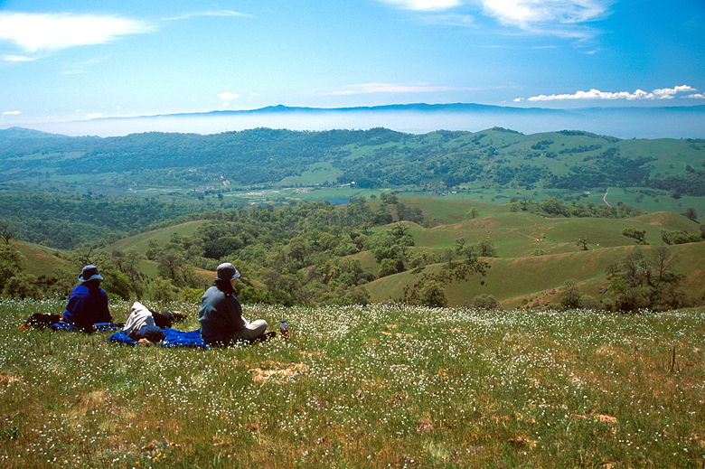
Lunch break
After lunch, we descended to Deer Valley, which was a grassy meadow
filled with yellow flowers. We turned left onto the Canada De
Pala Trail and skirted the western edge of the valley. We reached
the Line Shack, which is just a shack, perhaps a deserted horse
stable. From there we turned right and started another steep climb
until we found another wooden bench. Jean never met a bench she
didn't like, so we stopped briefly before turning left up the
short spur trail to Antler Point, elevation 2995. A couple of
bikers were already there, but they left shortly after we arrived.
There's another wooden bench there, though for most people their
feet won't touch the ground.
Tree looming over the trail
Antler Point would be a magnificent place to watch sunset. Unfortunately,
backpacking is not allowed, so we had to be content with the view
during the late afternoon. We could see the southern portion of
the Bay. Moffett Field was clearly visible, and most of the South
Bay, although it was covered by a white haze. Behind us, to the
east, the hills were already starting to turn brown. But in front
of us, everything was green. The series of trails leading home
was clearly visible on the ridge going south.
View from Antler Point
After enjoying the view, we headed back along the Pala Seca Trail.
As we did so, we started to see more and more people -- both hikers
and bikers, who were coming up from Grant Lake. When we reached
another section of the Canada De Pala Trail, I had to give in
to my allergies and sedate myself with half an antihistamine.
Experience had shown me that a whole antihistamine would leave
me groggy for at least the next 24 hours, so I was trying just
half for the first time. It worked pretty well.
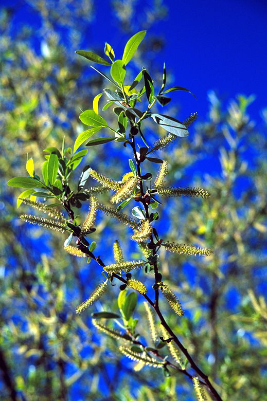
Fuzzies
We turned left onto the Canada De Pala Trail and then right onto
the Halls Valley Trail. As we descended, the vegetation changed.
Whereas before it was open grasslands, now the trees were thick
and the ground covered with vines and bushes. As we descended
we could see Grant Lake below. Soon we were at the lake, watching
families picnicking and people fishing.
| 

