|
Jennie, Kane, Lan and I hiked at Mount Tamalpais State Park.
On the first full day of spring, we drove through a thick mist
under a completely clouded sky, up and up to the Mountain Theater
parking area. Jennie and I ended up in the wrong parking lot;
half an hour after our original meeting time, Lan and Kane walked
down the road a short ways to find us.
The mist lent a strange, almost magical sense to the area. Trees
above us captured the moisture and drops fell from their soaked
leaves occasionally. A bit after 12:30pm (though it still felt
like morning), we finally started down the Rock Spring - Lagunitas
trail. The reason for the late start was that I'd intended to
catch the sunset. As it would turn out, however, there would be
no spectacular sunset to photograph.
The trail, a wide fire trail, headed uphill immediately. It was
a short climb, however, and we would be heading downhill almost
exclusively, down to Bon Tempe Lake. Rains left the trail soaked
and muddy in places. We had to step cautiously occasionally, but
generally the trail was in good condition. It was certainly a
favorite of mountain bikers, who passed us in both directions
the entire day.
The first part of the trail is partly through meadows, partly
forest. After passing Potrero Meadows, however, it is completely
forested for at least the next mile and a half.
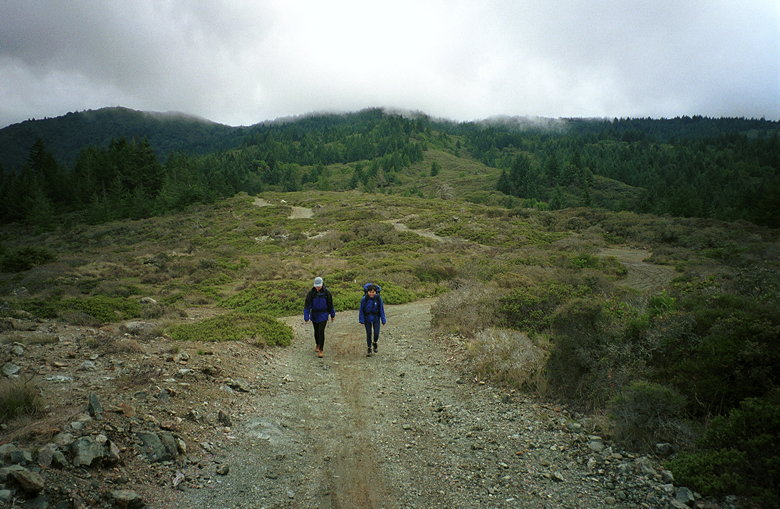
Jennie and Lan heading up Rocky Ridge
We turned left onto the Rocky Ridge trail. It was both rocky,
and a ridge, and gave us occasional glimpses of the lakes below
us. The clouds were high above us now, giving us good visibility
in all directions. This part of the trail was surrounded mostly
by small shrubs, including small manzanita trees. Along the way
we saw a salamander crossing the road and we closed in to snap
some pictures.
Turning a corner, we caught our first close view of the lakes.
A few minutes later, we were walking along the dam between Bon
Tempe Lake and Alpine Lake. A row of pelicans and sea gulls rested
on a bar in Bon Tempe Lake. As we were soaking in the views, hawks
started to ride the thermals, circling above us. They would start
low and gradually rise higher and higher. I whipped out my camera
as fast as I could to try to take some pictures, but the best
shots eluded me as usual.
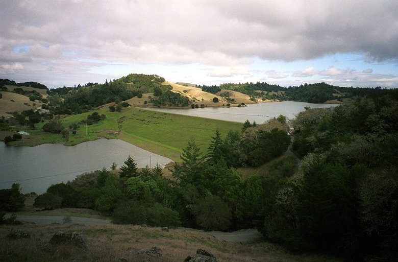
Alpine Lake (left) and Bon Tempe Lake
At this point, Kane turned around, since he had to get back early.
Jennie, Lan and I stopped at the dam and had lunch before heading
back up the same way we came.
The trip up was mostly uneventful. We simply retraced our steps
back up to Potrero Meadows. There, tired of hiking on fire trails,
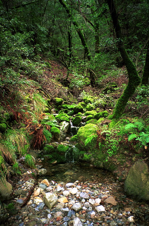
we decided to head southwest along the Potrero Meadows trail.
We passed through a meadow, of course, and a brief, damp, mossy
section next to a stream which was a nice treat after so much
forested fire trails.
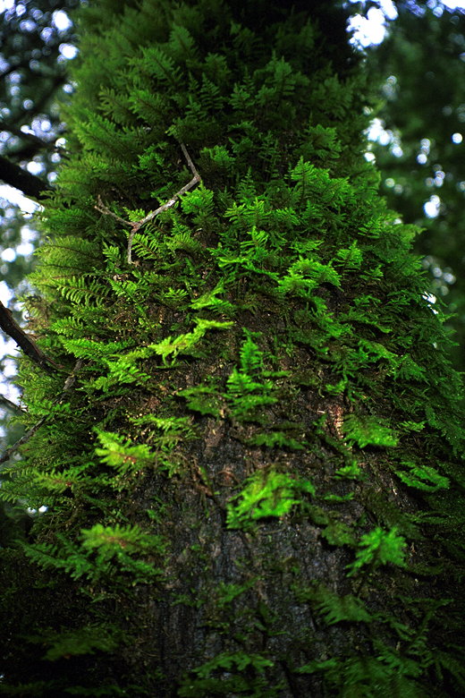
Fuzzy tree on the Potrero Meadows trail
A completely different world from the rest of the trails
We then headed up the Benstein trail. The going here was tough
at first, as it was hard to find the trail amidst the trees. This
was definitely not a fire trail. After some struggling, we managed
to find the main part of the trail. Or rather, some trail - I
was worried the whole time that we'd stumbled onto a different
trail and would end up far from our cars. But I kept my worries
to myself.
The trail was forested but narrow. It was a very different feeling
here. There was more of a feeling of isolation from the rest of
the world. Mountain bikers would not be bothering us. If we got
lost or injured, I wouldn't have been surprised if no one else
passed through the trail the rest of the day. Even with these
fears, it was still a nice trail. Lan spotted some red mushrooms
growing on either side of the trail. And eventually we emerged
from the trees to join up with the Rock Spring - Lagunitas trail
yet again.
Soon we were back at our cars. The weather now was much as it
was when we'd left them -- misty, cloudy. But that seemed just
about right.
| 

