|
Jean, Reza, and I went to Robert Louis Stevenson Park to hike up to Mt.
St. Helena.
I'd put off the hike earlier due to late El Nino rain, but this
time the weather held up. Rain had soaked the Bay Area the week
leading up to the hike, but the weekend itself was clear.
The drive is about 2 1/2 hours from the South Bay. We stopped
briefly in what I think is the town of St. Helena because Jean needed
some coffee to stay awake. The drive along 29 is beautiful --
wineries following us all the way to the hike.
The parking lot isn't well-marked, but we found it. About 20 other
cars were there, with a few other people getting ready to hike as we
rolled in around 11am. The sign which says Mt. St. Helena Trail is
actually a few dozen feet in, not visible from the road. But I asked
a man coming down the trail, and he verified it was the trail I
wanted.
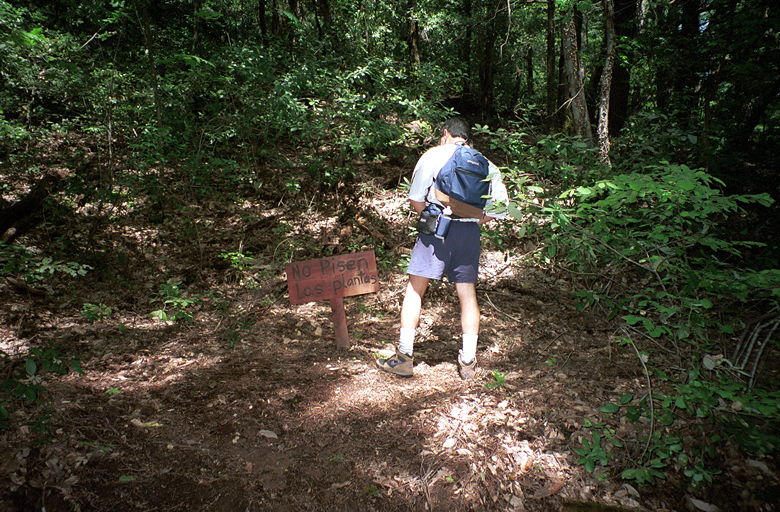
Reza taking a leak near the start of the hike. The sign
says "No pisen las plantas"
The hike starts in a densely forested area with a babbling brook and
signs encouraging hikers to stay on the trails. The trail has some
very generous switchbacks, and some hikers thought they were too
generous -- there are a lot of worn "trails" bypassing the corners of
the switchbacks.
The bottom 3/4 of a mile of the hike is one of the most pleasant
trails I've been on, rising fairly rapidly up the mountain. The
occasional car that can be overheard is the only blemish on an
otherwise peaceful, shaded trail. If only the entire 5.1 mile trail
to the top were like this. But alas, the trail soon emerges onto a
dirt fire road which runs all the way to the top of Mt. St. Helena.
This is a fairly well-used trail...in addition to an entire troop
of 20 or so teenagers coming down the mountain, we encountered a
dozen or two other hikers. One of the first people we ran into,
however, were a couple rock climbers. One was standing on the trail,
belaying his partner, who was halfway up a 30-foot rock. It had
plenty of grips on one side, but he was making it more challenging by
taking the harder, smooth route up.
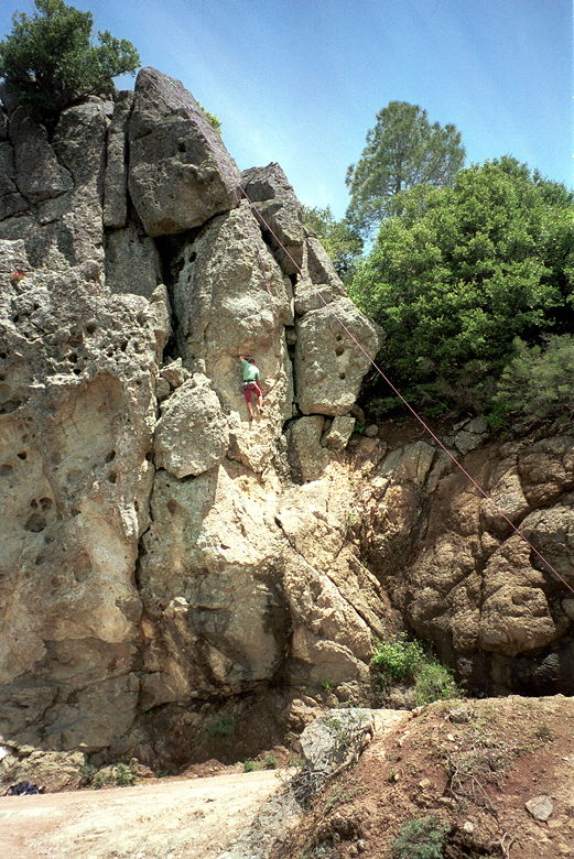
A rock climber halfway up a rock face near the beginning
of our hike
After cautiously passing them, we trudged along at a moderate grade,
gaining great views of the Napa Valley below. Unfortunately it hazy,
so the views weren't as great as they could be. Still, they were
impressive. A little later, we were passed by a pick-up truck. That's
never a good feeling as a hiker...to get passed by a motor vehicle.
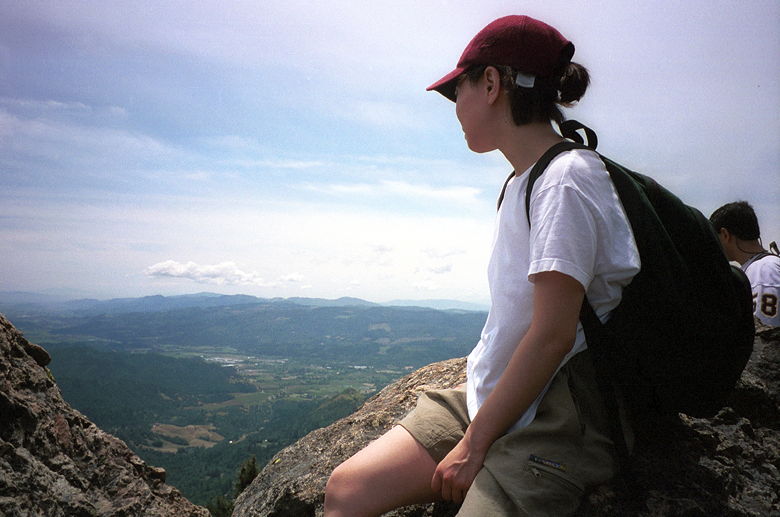
Jean looking down into the valley
Near the top, the trail steepens, and then steepens even more at the
very end. But the views from the top make it worth the effort. You
can see snow-covered mountains off in the distance to the north,
green all around, the Napa Valley to the west, and Lake Berryessa to
the south. One word of caution: as you get closer to the top, the
bugs seem to multiply, and we spent half our time at the time
alternately applying DEET and swatting bugs away from our faces. The
only other disappointment of the hike is the existence of
communications towers at the top of Mt. St. Helena, much like Montara
Mountain. The sign of "progress."
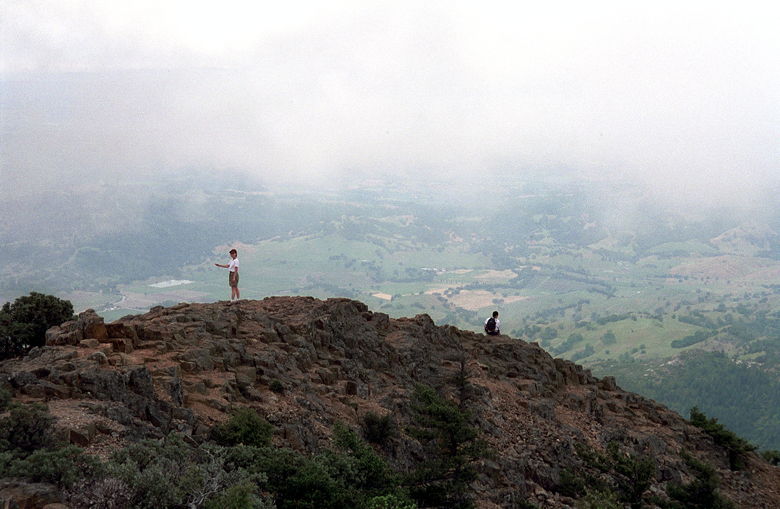
The clouds rush in soon after we reach the top
The clouds rolled in quickly while we were at the top. It was strange
to be above many of the clouds and see them from that perspective.
The clouds played hide and seek with the sun the rest of the
afternoon. But they also provided a rainbow ring around the sun.

Reza, scrambling up the last section of his killer 2000
foot rock climbing ascent
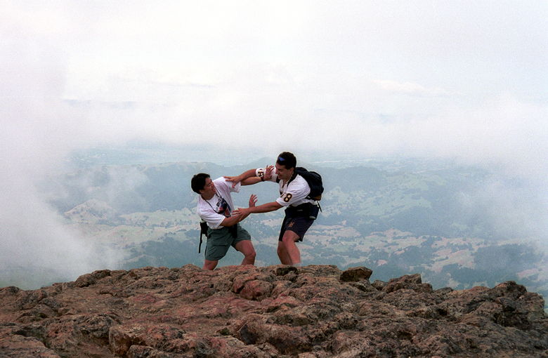
Clash of the titans!
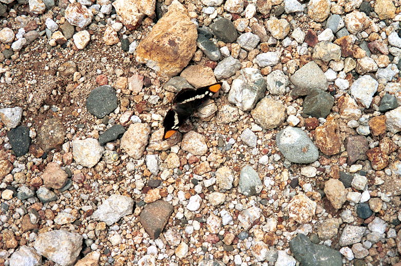
I snapped three shots trying to get this California Sister butterfly, so damn it, you're going to see a picture of it!
Reza really wanted to see Game 7 of the Eastern Conference Finals
(possibly Jordan's last game), and we all wanted to escape the bugs,
so we raced down the hill. Lizards scampered out of our way as we
walked by. We saw a few mountain bikers (some coming up, some going
down). I had expected more, given the road to the top.
Eventually we made our way back to the wooded area of the trail,
and enjoyed that final section back to the parking lot.
| 

