|
By the time we arrived at Castle Rock State Park at 2:15pm, Joe
had already been there for over an hour. We prepared our packs and
readied ourselves for the first part of the journey.
We had planned to start hiking before 1pm, leaving plenty of time
to arrive at Waterman Gap before 8:30 sunset. Unfortunately, our lack
of proper planning left us starting the hike at 2:50pm. This put us
under a lot of pressure to arrive soon enough before sunset to set up
camp and cook dinner. Joe had already seen a couple people start the
same trip we were attempting almost 2 hours before we did, so we were
just a bit worried.
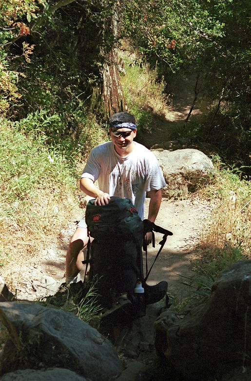
Joe takes a moment before strapping on the device of
torture again
The hike starts out along the Saratoga Gap Trail toward Goat Rock.
The trail immediately enters the forest; in fact, most of the trail
is shaded. The temperature was very moderate the whole hike -- high
70's I'd say.
I don't recall taking this fork, but we ended up on the Ridge
Trail toward Goat Rock instead of the Saratoga Gap Trail toward
Castle Rock Falls. Both forks will eventually take you to the same
place in about the same time and distance. However, the Saratoga Gap
Trail (left fork) gives more expansive views. On the other hand, the
Saratoga Gap Trail has some exposed areas which may be dangerous to
hikers with large packs on, as was the case with us.
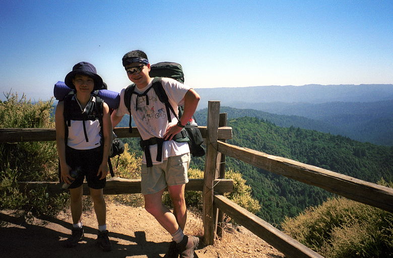
The view from the Ridge Trail
My full pack, with water and food, was 48 pounds at the start of
the trip (10 pounds of which was liquid). This is approximately 28%
of my body weight. Joe's pack was comparable in weight, and Jean's
was comparable as a percentage of her body weight. =) If you ever
carry 28% of your body weight on your back, you will understand the
position we put our bodies in when we rested. It takes great effort
to take the pack off and put it back on. So, to rest our weary
shoulders, we would, as Joe would say, "assume the position" --
standing, hands on knees, body bent over at the waist, pack almost
parallel to the ground. It was a great relief to assume the position,
but I must admit you will not find any pictures of it on my web site!
At Goat Rock, we passed by a group of kids who apparently had gone
out on a rock climbing field trip. We continued on the trail, past the
"naked" trees, eventually coming to a creek crossing. Unfortunately,
there was no bridge -- there was just a plank going to the other
side. Well, technically, there was a bridge -- it just wasn't
crossing the chasm. Inexplicably, it was resting comfortably on the
other side, lying on the ground. In any case, we crossed and
continued onto Castle Rock Trail Camp.
We refueled our bodies with food and water. The site also has
water and a vault toilet (this is really a euphemism for a shit hole
-- a semi-permanent out-house which may or may not have tiny sheets
of toilet paper).
Just as we were leaving, a group of backpackers came by from
another trail. We chatted for a few minutes. Apparently one of them
had a backpack which had been stolen a few days ago. We told them
where we were going, and they said we would have no problem getting
there before sundown. Those would be the last people we saw until the
Waterman Gap Trail Camp.
We continued along the Saratoga Gap Trail, and then left onto
Travertine Springs Trail. At some point around this time, Jean turned
on the afterburners, leaving Joe and me in her wake. Every time the
road turned steep, her arms would start pumping and she'd race up the
hill with quick, short steps. It would prompt cursing from Joe and me
as we failed to keep pace. But it was probably a good thing, since we
were really racing the sun.
Most of the trail is shaded, but a portion of the Travertine
Springs Trail is unshaded and very narrow. There are places where the
"trail" is no more than a foot wide, with prickly plants on both
sides, depositing their little devices of pain on our socks. But we
fought through and eventually made it to the Saratoga Toll Road, and
then the Beckhuis Road Trail to the Skyline To The Sea Trail. (I'm
not sure on the spelling of the Beckhuis Road Trail, as the spelling
on the map and trail post were different)
The Skyline To The Sea Trail begins at Saratoga Gap, and roughly
follows Highway 9 down to Waterman Gap. We joined it at a point
approximately 4 miles from Saratoga Gap, leaving a little over 2
miles to the Waterman Gap Trail Camp. As we walked just a hundred
feet below a windy road with cars speeding along at 40-50 mph , we
passed at least 2 cars which had, some years earlier it appeared,
failed to navigate a turn and tumbled over the edge, a hundred feet
below the trail. That made us just a little edgy and hoped that our
camp would be fairly distant from the highway itself.
The trail went up and down, up and down. None of it was very
steep, but it was somewhat demoralizing because we were never sure
how much more uphill there was. The day's hike would drop us
approximately 1600 feet overall. But that 1600 foot descent was
accomplished by ascending 1310 feet and descending 2910 feet. 1310
feet may not sound like a lot, but with 28% of your body weight on
your back, every ascent (and descent) is magnified.
We made it to the Waterman Gap Trail Camp at 7:30pm. We put our
packs down and talked to a ranger who'd driven there. He told us we
could pick any of the 6 campsites, and that there were supposed to be
a total of 15 campers there that night. He was wrong. There were the
people Joe had seen, already camped at site 2. And there was us. We
didn't see anyone else show up at that night.
Jean suddenly noticed she was being eaten alive by mosquitoes. She
battled them while Joe and I ran around looking at the camp sites. We
took camp 5 because it was large and somewhat far from the road (and
the other campers). The downside was that it was a bit of a hike back
to the water, garbage, and vault toilet at the front of the camp.
After setting up our tents and refilling our water bottles, we
started to cook in the dark. Well, it wasn't completely dark. There
was still some light in the sky, the moon as bright, and our
flashlights were working...for the moment.
Dinner for me consisted of a freeze-dried dinner with roasted
almonds (thanks, Joe) and honey mustard nibblers added for taste and
texture. Joe also had a freeze-dried dinner, and Jean made rice and
added a miso soup package for flavoring. It was actually quite good.
I'll have to try making rice next time -- it meets my criteria of not
having any water content (gotta work on lightening the load!).
My flashlight's batteries began to fade at the same time Joe's
did. Fortunately, Jean's candle lantern didn't have the same problem.
Next time I'll have to make sure my batteries are fully charged.
At night we could hear the noise of cars on Highway 9 in the
distance, but it wasn't enough to keep us awake. Unfortunately, the
heat was. The temperature inside my tent was a balmy 61 degrees (with
the rain fly on), and I was sweating inside my down sleeping bag. The
next night I promised myself I wouldn't wear my long pants to sleep.
| 

