|
Jean and I drove up to Letts Lake campground on Saturday. We took the scenic route --
Highway 101 to Highway 175, up Highway 29 to M1, then onto M10. M10 is a dirt road
which is really quite scenic and has some beautiful forested sections over red dirt.
It's also a bit adventurous, however. One section requires crossing a shallow creek;
not a big deal since it was only an inch or two deep, but it was something new for us.
In rainy years, this might be a consideration. Also a consideration would be the fact
that it took us 5 1/2 hours to cover the 200 miles to Letts Lake, whereas going via
Highway 5 would have
taken about 4 hours. But we didn't know that at the time.
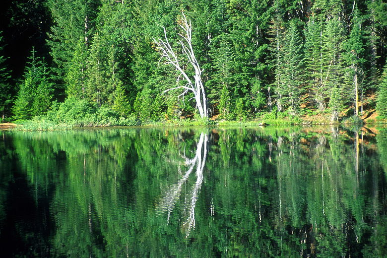
Reflection in Letts Lake
Letts Lake has three small campgrounds. We chose the middle one, next to the lake. It's
quite nice. In the morning I went out and saw that most of the people camping were up,
fishing in the lake. After packing up we made the 40 minute drive over dirt roads to
the Summit Springs trailhead in the Snow Mountain Wilderness.
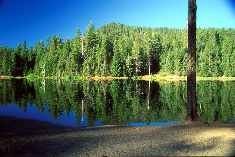
Letts Lake
Despite the remote location, there were about 10 other cars parked in the "lot," which
is really just a section of relatively open forest where people park their cars
between trees. This is more than I would have expected for a non-holiday weekend.
But once you visit, you'll understand why it's so popular. Still, we hardly saw anyone
on the trail, especially on the way back.
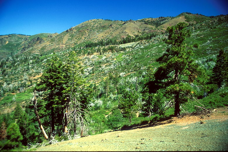
We signed in at the trailhead sign at about 10:30am. We then climbed up through the
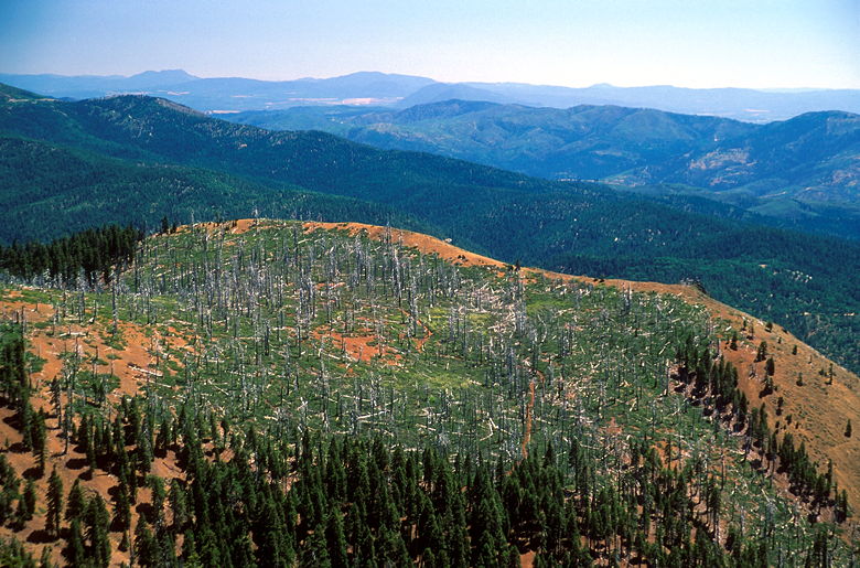
forest of tall trees until we reached an area with far-reaching views. The reason for
these views was a 1987 lightning-started forest fire which charred thousands of acres.
The forest is still recovering, with mostly bushes and short trees now, 14 years later.
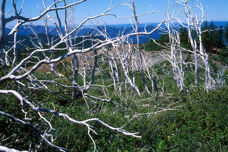
The visual remnants of the fire are hundreds or thousands of snags -- dead white tree limbs
reaching out into the sky like ghostly hands. They're interspersed among the green trees
and bushes. It's quite a site to behold.
Snags litter the mountain
Snags closer up
We continued past the snags and into another forested area. Along the way
we spotted wildflowers here and there along the trail. We reached a small open area with
lots of very large downed trees and dead, still-standing trees. To our right were good
views of the Sacramento Valley to the east.
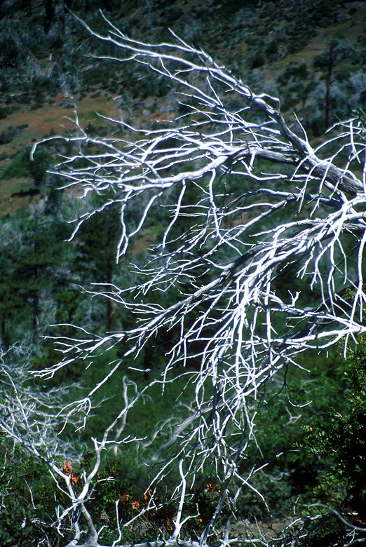
Snags even closer
Returning to the forest, the trail took on a Sierra-Nevada look. Like something you'd find
in Sequoia-Kings Canyon National Parks. We descended slightly to a small pond and
meadow -- Cedar Camp. A dozen kids were here, resting, apparently on their way back to the
parking lot after a backpacking trip. We continued on past them on the right fork, on
to the summit (the left fork goes to Milk Ranch).
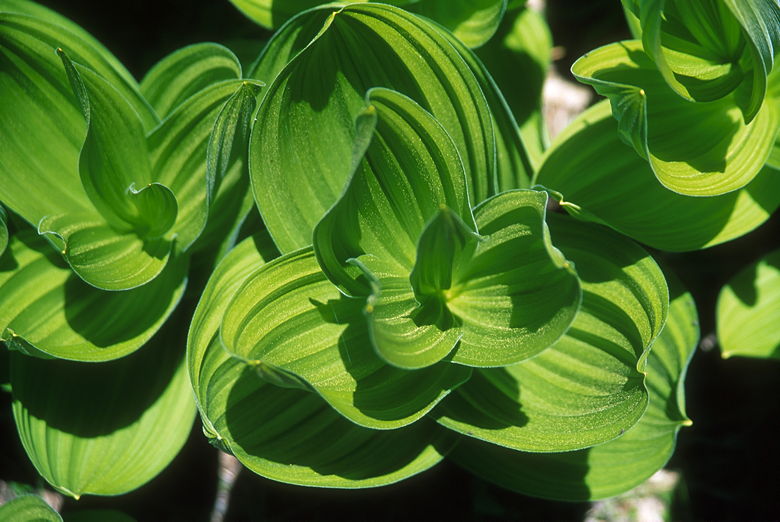
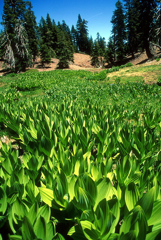
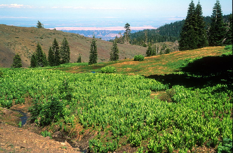
One of the many green plants growing along the streams
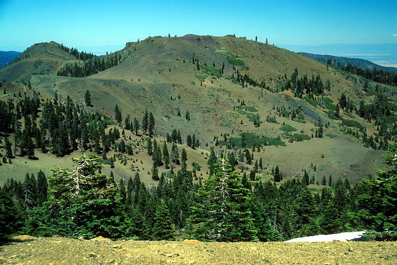
We continued climbing. We had 2 more miles to go to reach the summit now. Soon we had
our first view of the east summit and the saddle between the east and west summits. The
forest now opened up as we walked along mostly level ground. We walked past streams
fed from the melting snow on the north face of the west summit. There were patches of bright
green plants, close to the water. The plants were about a foot in height and simply
consisted of large leaves wrapped around themselves. Quite pretty. It added color to the
landscape, which was becoming more barren as we climbed toward the summits. The east
summit, in particular, looked almost completely devoid of life. -- just a smooth sandy summit
reminiscent of parts of the climb up Lassen Peak.
Green plants along a stream
We climbed through forest again to reach the saddle. We now had a choice. We intended to
climb both summits and we now had to choose which one to do first. We'd seen several
people hike to the top of the east summit. They were still there, so we decided to keep
our solitude by hiking to the top of the west summit first.
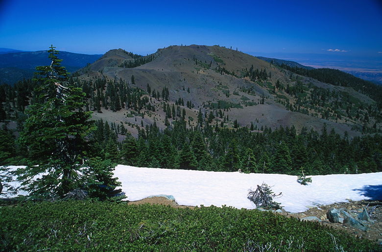
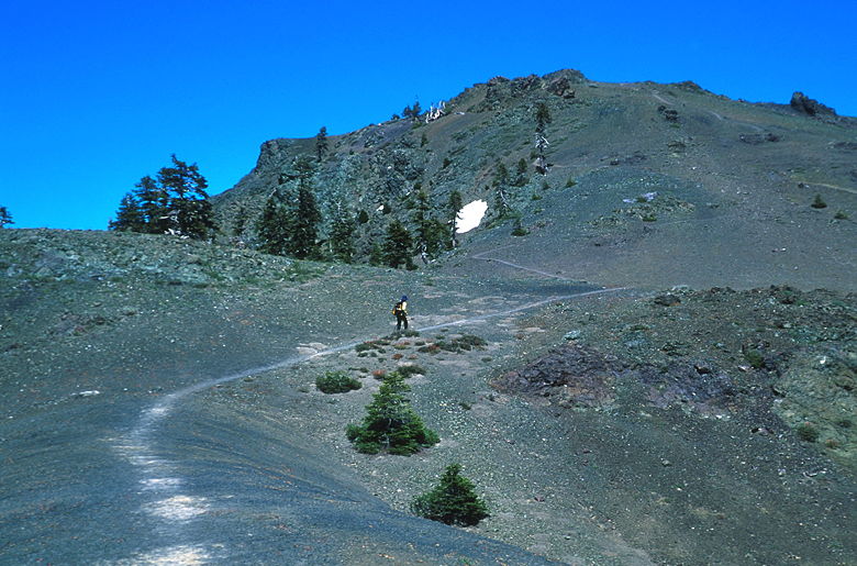
Not the best picture of Snow Mountain East, but I had to show the snow
We climbed a couple hundred feet before reaching the long summit plateau. It stretches
westward before turning south, a long shelf of snow still clinging to its northeastern
side. A small monument graces the very peak, but before you get there, enjoy the views
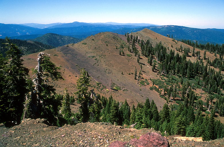
looking north and west. Range upon range of mountains spreading out into the hazy horizon.
To the south, more mountains. To the east, mountains leveling off into the Sacramento
Valley, punctuated by the odd sight of the Sutter Buttes -- 2000-foot high mountains rising
up out of the middle of nowhere, or at least the flatness of the Sacramento Valley.
They've been called the smallest mountain range in the world. Further east would be the
Sierra Nevada, but it was too hazy to see that far.
Burned area below Snow Mountain West
We found a spot amongst the trees just above the snow shelf, stopping to have lunch.
To the northeast, the view was dominated by the sight of Snow Mountain East. It was quite
windy as we had our lunch, ants scurrying at our feet. The only other signs of life were
lizards and what I think was some rodent making flute-like noises. Only it was too fast for
me to get a good glimpse of. I suppose it could have been a large lizard, but I don't
think so.
Snow Mountain East
We imagined what it would be like to camp on the summit. There are a
few places next to the trees which might provide some shelter from the strong winds. The
360-degree views, of course, would be astounding, especially at sunrise and sunset. And
the night sky would be amazing, as well. We'll probably revisit with our packs one of
these days. Water at the top could be a problem, but if you visit while there's still
snow, you can melt it for water. Just bring enough fuel.
I'm not quite sure what I expected, but the views exceeded my expectations. Reluctantly,
we finally pulled ourselves away as the group of hikers who'd been on the east summit now
joined us on the west summit. We would now trade places. We made our way down to the saddle
and then made the steep climb up to the slightly higher east summit. At 7056 feet elevation,
Snow Mountain East
has the distinction of being the California county highpoint of two counties -- Colusa
County and Lake County. The county line crosses somewhere south of the summit, so the
Lake County highpoint is not quite the summit, but a few feet below it. The views are
impressive, but probably not quite as good as the top of Snow Mountain West. This is
partly due, I think, to the "can't see it because you're on it" syndrome which explains
why I like the view from Brokeoff Mountain better than Lassen Peak.
Jean heading up the barren summit of Snow Mountain East
One thing we could see is a white triangle hanging in the sky to the north -- the snow-laden
slopes of Mount Shasta. Apparently Lassen Peak is also visible, but I didn't see it (didn't
really try, actually). Besides the views, also on the summit you'll find the summit
register, which is bolted into a rock and has a screw-on lid. Inside we found a notebook.
I read the entry from the people we'd just seen, then added our own entry.
View from the trail looking west
After enjoying the views, it was time to start the descent. We didn't see another person
from the time we left the west summit until the time we reached the parking lot. We
retraced our steps down to the saddle, past the streams, and onto Cedar Camp. The
backpackers were long gone by this time. We continued our descent. I had been hoping for
better lighting in the afternoon, but it was still too early in the afternoon, and the
angle of the sun just made things hazy so I ended up not taking pictures on the way back.
Another reason to camp on the summit.
Looking down to the Sacramento Valley
It was nearly 5:30pm by the time we reached the parking lot. One other car was still there,
but they left while we got ready to leave. We decided to take Highway 5 back. It took us
just under 4 hours to cover the 215 miles back home, a much better drive than Highway 101.
It's also quite a scenic drive, as well, going through tiny towns and past rolling
hills and farmland. We'll come back this way sometime to revisit the beautiful
Snow Mountain Wilderness.
| 

